Kananaskis, Alberta
Looking for the best hiking in Kananaskis? We've got you covered with the top trails, trips, hiking, backpacking, camping and more around Kananaskis. The detailed guides, photos, and reviews are all submitted by the Outbound community.
Top Hiking Spots in and near Kananaskis
-
Turner Valley, Alberta
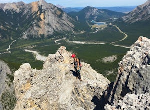
Climb Wasootch Tower
Park at Wasootch Creek, Walk 2kms past the practice slabs5.7 Mixed- North RidgeFollowing the drainage on the right side that leads to the base of the esthetic tower. Then hike up the faint forested trail to the beginning of the climb.I found this to be a fun- easy scrambling route with quite a fe...Read more -
Canmore, Alberta
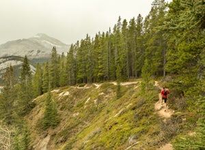
Trail Run on the Wind Ridge-Bow Valley
8.4 miWind Ridge is a 7,217 ft / 2,200 m mountain peak near Canmore, Alberta, Canada, with spectacular views into the Bow Valley. The trail is primarily used for hiking and is accessible from May until November.Take the Spray Lakes Road from the town of Canmore for 22km. The trail head is just below th...Read more -
Canmore, Alberta
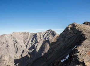
Hike Grotto Mountain
7.5 mi / 4429.1 ft gainFrom Highway 1A take the exit to the Alpine Club of Canada. Park near the woodpile as the actual parking lot is for Alpine Club customers. The trailhead about 30 metres up the road from the woodpile.The start of the trail is fairly relaxed but it quickly becomes a steep uphill battle. There are t...Read more -
Canmore, Alberta
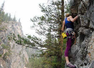
Rock Climb at Cougar Creek Canyon
4.03.1 mi / 49.2 ft gainFrom the TransCanada highway, take the second exit into Canmore (from either direction), and head uphill on Elk Run Boulevard. At the top of the hill, across from the Iron Goat restaurant, there is a three way intersection, head right across the bridge and take an immediate left into the parking ...Read more -
Canmore, Alberta
Mount Lady Macdonald Scramble in Winter
3.5The Mount Lady Macdonald trail begins at Cougar Creek, starting out as a leg burner through the forest, then meandering through boulders, halfway up. The boulders, sparse forest, and views of the Bow River Valley make for a classic mountain landscape that isn't always offered by forested walks to...Read more -
Kananaskis, Alberta
Winter Climb Mount Allan
5.08.7 mi / 4429.1 ft gainMount Allan is a 14 km hike that gains 1400 metres of elevation and was one of my favourite hikes when I first moved to Calgary. On a recent snowshoe, a couple I crossed paths with mentioned they had just done Mount Allan in December, so I knew I had to put it on my winter list!The trail begins a...Read more -
Kananaskis, Alberta
Memorial Lakes
9.9 mi / 2624.7 ft gainHistory Note: This hike commemorates 13 passengers of three different air crafts that went down in the region in 1986. The first was a passenger plane, and the second two were search and rescue aircraft. There is a plaque at the top of the hike to commemorate the lives that were lost. Take Hwy...Read more -
Kananaskis, Alberta
Ribbon Falls
3.812.4 mi / 1148.3 ft gainRibbon Creek trail is accessible via Highway 40 at the turn off for Nakiska Mountain Resort. From there take a left at Centennial Drive and then a right onto Ribbon Creek Road. The hike begins at the far end of the Ribbon Creek Trailhead parking lot. There is an old coal mining cart at the start...Read more -
Kananaskis, Alberta
Hike Centennial Ridge
9.9 mi / 4592 ft gainThis hike can be done as a full traverse, starting at the Ribbon Creek Trailhead and taking you to Dead Man's Flats, just off of the Trans Canada Highway. Starting at the trailhead in the Ribbon Creek parking lot, go north on Hidden Trail. You will be on this trail for ~ 200 m before you need to ...Read more -
Kananaskis, Alberta
Hike up Windtower Mountain
5.06.2 mi / 3182.4 ft gainSpray Lakes is one of my favorite areas in Kananaskis, and the view of Spray Lakes from the summit is absolutely breathtaking.The trailhead is located along the Smith-Dorrien Trail (Spray Lakes Road) – look for a yellow sign on the eastern side of the road, about 1 mile (1.5 km) south of the Drif...Read more -
Canmore, Alberta
Hike to Grassi Lake
4.52.4 mi / 820.2 ft gainTo get to the Grassi Lake trailhead, continue past the Nordic Center about 2km and take a small left when you reach a junction between a gravel road and a paved road. You want to be on the paved road, as this will lead you down to the Grassi Lake parking lot. The trail starts right behind the res...Read more -
Kananaskis, Alberta
Hike Spencer Creek
2.5 mi / 1968.5 ft gainSouth of the Driftwood turnoff (approximately 4 km) on Spray/Smith-Dorrien Trail a large creek bed on the east of the road is the beginning of Spencer Creek. The trail is easy enough to find, just have to do a bit of looking.Once on the trail, you'll basically have no trouble at all. The trail it...Read more -
Kananaskis, Alberta
Snowshoe to Old Goat Glacier
6.2 mi / 2296.6 ft gainThe trialhead is found on West Side Road on the west side of Spray Lakes Resevoir. In winter, West Side Road is closed to vehicles due to dogsled tours, but is still open to walking - it's a pretty neat experience to get passed by a dozen sled dog teams. Since the road is closed, it adds an extra...Read more -
Kananaskis, Alberta
East End of Rundle Scramble
4.44.7 mi / 2880 ft gainThis well marked, fun hike that has a bit of everything, from easy forest walking, to steep slabs, minor hands on scrambling, and a scree slope to the summit.From the parking lot, head north up the hill, where the trail begins around the power poles. There a few different paths to start, so it's ...Read more -
Kananaskis, Alberta
Scramble up Mount Sparrowhawk for Sunrise
7.5 mi / 4527.6 ft gainMount Sparrowhawk was the first mountain I ever fell in love with -- I knew it well, and I knew that the summit would still be accessible with a bit of snow on it in October. With waning daylight hours, it was a perfect option - albeit intense - for a sunrise hike.The trailhead is located on the ...Read more -
Canmore, Alberta
Ha Ling Sunrise Hike
4.15 mi / 2296.6 ft gainStart at the Goat Creek parking lot and cross the road towards Ha Ling. There is an access road with a gate on the other side. Walk up the road and across the bridge. From there the trail is obvious and will lead you to the summit. Overall it's a fairly easy hike with switchbacksOnce above tree l...Read more

