Kananaskis, Alberta
Looking for the best hiking in Kananaskis? We've got you covered with the top trails, trips, hiking, backpacking, camping and more around Kananaskis. The detailed guides, photos, and reviews are all submitted by the Outbound community.
Top Hiking Spots in and near Kananaskis
-
Banff, Alberta
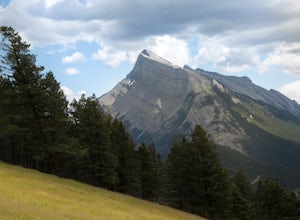
Take in the View at the Mount Norquay Green Spot
3.5The "Green Spot" is a beautiful grassy slope that opens up to sweeping views of downtown Banff and the surrounding area. It's a great spot for photography, especially capturing the peak of Mt. Rundle. There's also a set of chairs conveniently placed on the slope so you can kick back and enjoy t...Read more -
Banff, Alberta
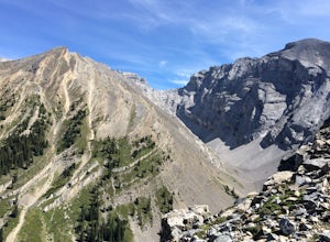
Hike Cascade Mountain, Banff NP
7.5 mi / 4800 ft gainFrom Banff, follow the Norquay Road (the west access road to Banff) up to Mt. Norquay Ski Area. The trail begins from the day lodge at the far end of the first parking lot on the right.Walk by the front of the day lodge and follow a service roaddown through the ski area past the base of three cha...Read more -
Banff, Alberta
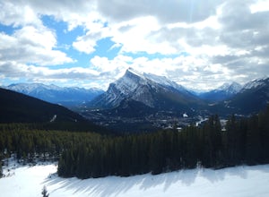
Snowshoe Mt. Norquay
2.2 mi / 1000 ft gainFrom Banff:Take the shuttle from the town lot to Mt. Norquay Ski Lodge, it is $10 CAD one way or $15 roundtrip, but you may want to walk back. If you decide to walk back there are two options; the road or the beautiful mountain trail. The trail head can be easily picked up in the parking lot, hik...Read more -
Kananaskis, Alberta
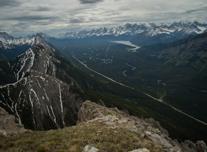
Hike Alberta's Grizzly Peak
4.0The trailhead is located on the north side of Ripple Creek, the first creek you come across after passing the Grizzly Creek turnoff. There is an easy pull-off on the east side of the highway. You should be able to see the trailhead from the road, which follows the southern slope of the mountain f...Read more -
Bragg Creek, Alberta
Cross-Country Ski and Scramble to Oldforgetmenot for Sunrise
9.9 mi / 2395 ft gainI think it's because I tend to watch football on Sundays that I've started doing more sunrise hikes --- can't say I regret it either! Oldforgetmenot is a perfect objective to take in a sunrise on: elevation gain isn't too intense, distance isn't too trying, and there are quite a few stretches tha...Read more -
Bragg Creek, Alberta
Scramble Mount Glasgow
3.014.3 mi / 4265.1 ft gainAs with most hikes in the Bragg Creek/Little Elbow area, the trail begins at the Little Elbow campground. To make the hike a tiny bit shorter, most people bike for the first 4 km on the Big Elbow trail to South Glasgow Creek. If you're not using a GPS trail, you'll know you're at the creek once y...Read more -
Bragg Creek, Alberta
Hike Nihahi Ridge
4.58.1 mi / 2624.7 ft gainThis year on the summer solstice, I was invited to go up Nihahi Ridge to celebrate. It's in one of my personal most underrated areas of the Rockies just west of Bragg Creek, and it's a popular objective, but less so during the evening. The trail begins once you park your car at the Little Elbow p...Read more -
Improvement District No. 9, Alberta
Hike the Cory & Edith Pass Trail
4.09.3 mi / 3002 ft gainGoing west from Banff, take the first exit for Highway 1A (Bow Valley Parkway). Take the first right up to the fireside picnic area and begin your hike here. The first 5kms of the hike climb uphill through the forest, making up most of the 915m elevation gain. Watch for trail markers over the ro...Read more -
Edgewater, British Columbia
Scramble the Towers
12.4 mi / 3937 ft gainFrom the Assiniboine Lodge (or your campsite or your hut), follow directions to Wonder Pass. After the pass, there are two ways to get up to The Towers, which you can see on the map in the pictures. The first option is to keep going on Wonder Pass Trail a bit further, lose some elevation and cut ...Read more -
Edgewater, British Columbia
Hike to Windy Ridge
10.6 mi / 1640.4 ft gainWindy Ridge is located by Og Pass in the Mount Assiniboine Provincial Park. Whether you start from any of the campgrounds, huts or the lodge, the way to the Windy Ridge Trail is well indicated and the trail itself is well worn. Beware that if you are using the Gem Trek map (1:100,000), the notes ...Read more -
Edgewater, British Columbia
Hike to Nub Peak
5.07.3 mi / 2789 ft gainStarting right at Mt. Assiniboine Lodge, there is very clear signage for this hike. The arrows will lead you over a wooden walkway right before you begin a gentle assent through the woods,gaining elevation the further you go, and then arrive at The Nublet which is before the peak. The Nublet has ...Read more -
Edgewater, British Columbia
Explore Mount Assiniboine Provincial Park
5.0Mount Assiniboine Provincial Park is a UNESCO World Heritage Site sequestered 27 km from the nearest road. We took a helicopter in, and hiked out . You can also hike both ways, but the hiking once you are there is more amazing than on the way in. You can also ski in on backcountry skis in the Win...Read more -
Kananaskis, Alberta
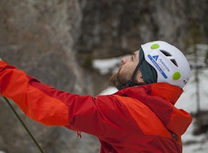
Ice Climb at King Creek
4.0Follow the defined path trailing roughly along the creek bed, a 20 minute hike from the car park. King Creek lies at the bottom of a gorge with steep rock walls on either side and a cascade of fat ice being forced out of the rocks. It's a gorgeous spot, showcasing the true beauty of Kananaskis.It...Read more -
Sawback, Alberta
Hike Mount Bourgeau
5.012 mi / 2460 ft gainTaking Hwy 1 West of Banff for approximately 8 miles you'll come to the Bourgeau Lake Trailhead. This trail starts with a 4.5 mile, 2460ft elevation through the forest to the beautiful Bourgeau Lake. This glacial tarn signals the start of the alpine and a wonderful morning hike on it's own. From ...Read more -
Sawback, Alberta
Hike to Bourgeau Lake and Harvey Pass
5.012.5 mi / 3360 ft gainThe trailhead for Bourgeau Lake/Harvey Pass is on the west side of Trans-Canada Highway approximately 5 miles west of Banff. The turn-off is approximately 0.9 miles past the Sunshine Village Ski Resort exit. There is a small parking lot and a restroom at the trailhead. Enter through the gate to...Read more -
Sawback, Alberta
Hike to Bourgeau Lake
9.3 mi / 2329.4 ft gainThe Bourgeau Lake trailhead offers easy parking and bathrooms before departing. The hike begins with approximately an hour and a half of fairly easy walking through forest with several glimpses of the surrounding mountains and Wolverine Creek. This first stretch ends with a gorgeous waterfall, ...Read more

