Kananaskis, Alberta
Looking for the best hiking in Kananaskis? We've got you covered with the top trails, trips, hiking, backpacking, camping and more around Kananaskis. The detailed guides, photos, and reviews are all submitted by the Outbound community.
Top Hiking Spots in and near Kananaskis
-
Banff, Alberta
Hike Tunnel Mountain, Banff
4.02.7 mi / 984.3 ft gainThe lower trailhead is only a short walk from Downtown Banff. Head east on Wolf street and up St. Julien Road and you will see the trailhead shortly after passing Wolverine street.There is also a upper trailhead on Tunnel Mountain Drive across from the carpark and viewpoint. Although this is clos...Read more -
Improvement District No. 9, Alberta
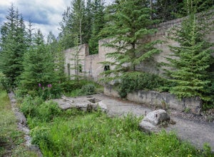
Explore Bankhead Ghost Town
5.00.81 mi / 37 ft gainBankhead is a ghost town which flanks Cascade Mountain and lies just south of Lake Minnewanka in Banff National Park. The main portion of the ghost town is located in Lower Bankhead, which can be reach by traveling North on Range Rd 1158 (closed Nov - Apr), following the signs to Lake Minnewanka....Read more -
Kananaskis, Alberta
Hike Opal Ridge's South Summit
5.0Opal Ridge is located on the East side of highway 40 in Kananaskis.The trailhead starts at Fortress Gas Station. Park at the North end of the parking lot. The trailhead is easy to spot from here. Follow the creek a couple hundred meters till you reach an open area with power lines. Turn left. Con...Read more -
Banff, Alberta
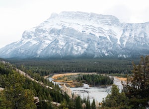
Hike to the Hoodoos, Banff
5.03 mi / 295.3 ft gainThe beginning of this hike is easily accessed from the town center of Banff by the Bow river. Perfect for those without a car! Follow the trail on the side closest to town as it leads up the Bow River and into the forest following the signs for Hoodoos Loop.The hike is 4.8km one way, leading arou...Read more -
Bragg Creek, Alberta
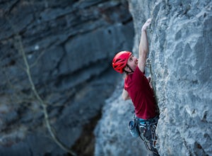
Rock Climb at White Buddha
4.01.9 mi / 492.1 ft gainTo reach White Buddha, park at the Powerface Creek parking lot. Between December and May, Route 66 is closed at Elbow Falls, so you may need to park at the gate and walk in, about 0.3 miles (500 m). The trailhead is well marked from the parking lot.The first section of the trail is mellow, though...Read more -
Bragg Creek, Alberta
Hike White Buddha via Powderface Trail
3.02.5 mi / 1148.3 ft gainFollow Hwy. 66 until you come upon the Powderface Staging Area. This is the trailhead. If you are coming between December & May, park at the Elbow Falls Day use area and walk along the road approximately 100 meters. This trail is easy to find and is quite wide. Follow the Powderface Creek Tra...Read more -
Bragg Creek, Alberta
Winter Hike Up Vent's Ridge
Whether it was the unseasonably warm weather; the forested, uneven, foot-wide, root-covered trail; limestone cliffs towering above me; the view of Myosotis Peak from the ridge; or exploring along Powderface Creek on the descent, this trail was an absolute blast.If you do this hike in February lik...Read more -
Bragg Creek, Alberta
Prairie Mountain and Elbow Falls
4.422 km west of Bragg Creek, turn off Highway 66 at the Elbow Falls Parking Lot. Park on the North side of the road on the shoulder at the winter closure gates. The trail is well-defined and heads straight up (North) from the highway.The trail begins with some steep switchbacks, but then levels out...Read more -
Bragg Creek, Alberta
Hike Iyarhe Ipan
3.02.5 mi / 1476.4 ft gainIyarhe Ipan means "mountain point" in Stoney, and while it's far from the highest peak you'll ever climb, it certainly is worth it. Iyarhe Ipan was the fix for the scrambling itch I've had all winter.Before Highway 66 opens in the summer, you'll have to park your car at Elbow Falls parking lot an...Read more -
Kananaskis, Alberta
Scramble the Fortress
Have you ever done a hike where you just don't want the day to end? Scramble the Fortress and you'll know the feeling. The thing that drew me to the Fortress was its summit elevation of 3000 masl, as well as its blocky, fortress-like profile when viewed from the north. It's so much more than that...Read more -
Kananaskis, Alberta
Backpack the Fortress Cirque
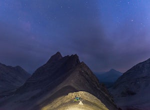
5.012.19 mi / 3507 ft gainNo better way to watch the stars with friends than huddled up in your sleeping bag on top of a 3000m summit. This describes the bivy at The Fortress. Starting at the Chester Lake Trailhead, take the unmarked trail on the right side of the parking lot. These winter cross-country ski trails take y...Read more -
Kananaskis, Alberta
Hike from Headwall Lakes to Chester Lake
5.010.6 mi / 2650.9 ft gainThe hike starts at the Chester Lake trailhead along the Smith Dorian road in Kananaskis. The first few kilometers follow the old logging roads, now used as cross country skiing trails. Find the beginning of the trail at the upper right end of the parking lot, and continue to follow parallel to t...Read more -
Kananaskis, Alberta
Hike to Chester Lake
5.06.2 mi / 984.3 ft gainChester Lake was officially one of my favorite hikes of 2016. It's a short & sweet 5 km's to the lake, with outstanding views in every direction. Fall colors were just starting to peak through and the sky looked amazing. From what I understand, this is one of the more popular hikes in the are...Read more -
Kananaskis, Alberta
Exploring Burstall Pass
5.0Head to the northwest corner of the parking lot to find the trail. For the first 5.5 km the trail is quite easy, with only modest elevation increase. At 5.5 km you will arrive at what is known as the gravel flats. Depending on the time of year the gravel flats can be either quite dry or a wide, s...Read more -
Kananaskis, Alberta
Hiking Burstall Pass
5.09.3 mi / 1542 ft gainThe trail begins along the berm beside Mud Lake. After a rather uninspiring 3 km (you can mountain bike this part) the trail narrows and enters trees where tangled roots twist across the path and you breathe in the smells of damp earth and moss.Ten minutes later the trail spits you across a spl...Read more -
Bragg Creek, Alberta
Hike to Bragg Creek Ice Cave
4.04.3 mi / 5879.3 ft gainAlso known as Moose Mountain Ice Cave, Canyon Creek Ice Cave and Ing Mine.The cave is located on the west side of Moose Ridge andhas a huge entrance, it is approximately1,600 ft. in depth. Take Highway 22 past Bragg Creek, continue on the 66 towards Moose Mountain. Turn off at Canyon Creek Road...Read more

