Kananaskis, Alberta
Looking for the best hiking in Kananaskis? We've got you covered with the top trails, trips, hiking, backpacking, camping and more around Kananaskis. The detailed guides, photos, and reviews are all submitted by the Outbound community.
Top Hiking Spots in and near Kananaskis
-
Improvement District No. 9, Alberta
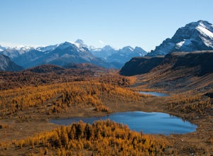
Hike to Healy Pass
7.5 mi / 2198.2 ft gainHead up to Healy Pass in late September or early October to check out the beautiful larch trees in their golden glory. Sunshine Meadows, Assiniboine, and other amazing views can be seen from the top of this easy trail. Start your adventure in the Sunshine Village ski resort parking lot. Head behi...Read more -
Improvement District No. 9, Alberta
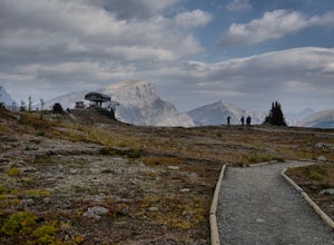
Sunshine Village Gondola and Standish Quad Chairlift Hike
6.2 mi / 902.2 ft gainIf you're looking for an adventure in the Banff area that's not as crowded as the main tourist attractions but offers as spectacular of views, check this gem out. Make sure to check hours of operation before going, gondola/ ski lift are not always running. Ride the gondola all the way to the to...Read more -
Banff, Alberta
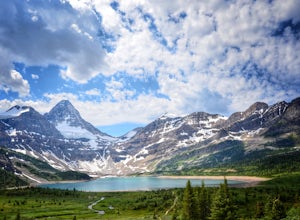
Mount Assiniboine: Sunshine Village to Mount Shark
5.036.37 mi / 5869 ft gainThis trek specifically covers the distance from Sunshine Village to Mount Shark. You will need a car at Mt. Shark, as there are no shuttles from that location to Canomre or any local areas. Otherwise, you can try to hitch a ride back – your best bet is to talk with some locals or visit the Canmor...Read more -
Kananaskis, Alberta
Hike Mount Indefatigable
4.5If you choose to do this hike, you'll find yourself at Kananaskis Lakes, one of my favourite spots in K-Country! Park your car at the Interlakes parking lot, have that one last bathroom break, and make your way north to get to the trailhead. The trailhead is impossible to miss as it's blocked off...Read more -
Kananaskis, Alberta
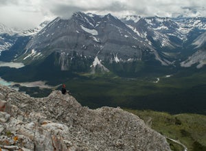
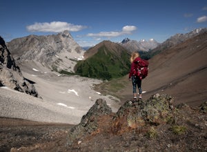
Backpack the Northover Ridge Loop
5.025 mi / 4000 ft gainWhile most people opt to hike this route as a 2 or 3 day trip, camping at Aster and Three Isle Lakes, this description is for a 1 day loop. This is NOT an easy hike to do in 1 day, however, and the ridge is no pushover for any length trip. Exercise caution and don't be afraid to backtrack if weat...Read more -
Kananaskis, Alberta
Rawson Lake & Sarrail Ridge
4.06.8 mi / 2427.8 ft gainTake Hwy. 40 to Kananaskis Lakes Trail. Continue on this road until you reach a turn off for Upper Kananaskis Lake Day Use Area. This is your trail head. Follow the trail along west side of the lake. After about 1 km you will reach Sarrail Falls. Shortly after crossing the bridge, take the trail ...Read more -
Kananaskis, Alberta
Rawson Lake
4.55 miGetting There From Highway 1, Take Highway 40 South to Kananaskis Lakes Trail, and turn left at Upper Kananaskis Lakes Drive. The Trail The trail to Rawson Lake starts at the end of the "Day Use Area" at Upper Kananaskis Lake. The lake gently laps the shoreline to the right and moss carpets the...Read more -
Kananaskis, Alberta
Hike the Aster Lake Trail in Kananaskis Provincial Park
7.5 mi / 1969 ft gainA long day hike or perfect backpack trip, this alpine lake surrounded by high peaks, starts out relatively easy from the upper Kananaskis Lake parking lot, at the far end of the south side of the lake, with a short tour around the east side of Hidden Lake, you start, what at some points will seem...Read more -
Improvement District No. 9, Alberta
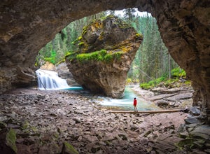
Hike to the Johnston Canyon Cave
4.43.4 mi / 700 ft gainIt’s amazing how much varied scenery you see over the course of the very short 1.7 mile hike. Follow the catwalks through the canyon as the stunning turquoise water flows below. If you’re feeling up for a longer hike, you can continue along the trail to the Ink Pots (makes for a great winter hike...Read more -
Improvement District No. 9, Alberta
Hike to the Ink Pots via Johnston Canyon
3.87.5 mi / 1050 ft gainThe hike through Johnston Canyon to its Upper and Lower falls is one of the most popular hikes to do in Banff - mostly due the little effort required for the great reward.To start, take the Bow Valley Parkway (Highway 1A) - the parking lot and trailhead are clearly marked by a Johnston Canyon sig...Read more -
Improvement District No. 9, Alberta
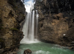
Hike Johnston Canyon
5.01.6 mi / 393.7 ft gainGetting There: The Canyon is very well marked, but here are directions anyway if you're coming from Banff: Head West on the Trans-Canada Highway for about 5 km or so. Take the Bow Valley Parkway exit, and continue West for another 18km - you'll then see signs to your right for Johnston Canyon. Th...Read more -
Kananaskis, Alberta
Hike to Grizzly Ridge near Highwood Pass
4.2 mi / 1840.6 ft gainThe hike starts at 2206 meters elevation Highwood Pass, and takes you through beautiful Pocaterra Cirque up to the peak of Grizzly ridge at 2767 meters, an impressive altitude to attain with only a 561 meter climb.Park at the parking lot at Highwood Pass, and follow the interpretive trail to a s...Read more -
Kananaskis, Alberta
Hike Ptarmigan Cirque
4.03.1 mi / 754.6 ft gainPtarmigan Cirque is a great beginner hike in Highwood Pass. Take Hwy. 40 approximately 50 km's from Hwy. 1. You will find the trail head at the Highwood Pass Day Use Area. This interpretive trail heads north along the road for about 100 meters and then crosses the highway. The trail is easy to na...Read more -
Kananaskis, Alberta
Scramble Mount Rae
4.0Mount Rae has given me the slip a couple times before, so I opted to take it on solo in the hopes of getting a successful attempt in. Damn, this is a good one.Park at the Highwood Pass parking lot, and start off on the Ptarmigan Cirque Trail. Forested until you get to the cirque, check beforehand...Read more -
Kananaskis, Alberta
Hike Pocaterra Ridge
4.09 mi / 650 ft gainDuring the fall I find the biggest treat is the changing of the larch trees and the beautiful contrast they provide against the landscape with their intense golden yellow colors. One of the best places to experience this is Pocaterra Ridge, located in the Highwood Pass of the Kananaskis region in...Read more -
Kananaskis, Alberta
Explore the Pocaterra Cirque
Start at the Pocaterra/Highwood pass parking lot. The pond is about 1.5km directly west from the parking lot, but the trail head is not always obvious, especially if there is snow. Keep an eye out for the flagging tape that marks the trail. Consider bringing snowshoes in November.This makes for ...Read more

