White Rock, British Columbia
Looking for the best photography in White Rock? We've got you covered with the top trails, trips, hiking, backpacking, camping and more around White Rock. The detailed guides, photos, and reviews are all submitted by the Outbound community.
Top Photography Spots in and near White Rock
-
Maple Ridge, British Columbia
Hiking Golden Ears Trail
14.9 mi / 4921.3 ft gainGolden Ears is well known to those in the Lower Mainland. After staring at the jagged 'ears' from all angle, I finally got to see them up close and in-person. The West Canyon Trail is a gentle 5.5 kilometers on a well groomed path, lined with deciduous trees making it a perfect place to watch the...Read more -
Maple Ridge, British Columbia
Camp in Golden Ears Provincial Park
11.2 mi / 3937 ft gainBackcountry permits are required to camp on Panorama Ridge ($5) and can be paid online.The trailhead is located at the West Canyon Parking lot. The trail starts out on a relatively flat old logging road. The trail slowly gains elevation over three kilometers taking you through thick green forest ...Read more -
Maple Ridge, British Columbia
Summit Golden Ears
4.514.9 mi / 5039.4 ft gainDay 1 Starting from the Golden Ears parking lot, your journey begins up a relatively small incline passing two bridges and entering the forest. Continue through the forest passing small cliffs and revealing some views of what you are going to climb the next day. Your estimated time it should take...Read more -
Maple Ridge, British Columbia
Hike to Alder Flats in Golden Ears Provincial Park
4.06.8 mi / 918.6 ft gainIf you're looking for a challenge and hope to get into the mountains this is a great adventure to set out on.Be prepared: Water, a lot of time, and with an understanding of the elevation gain will be important. This hike to the viewpoint of Alder Flats (overlooking the ears) takes around 2 hours ...Read more -
North Vancouver, British Columbia
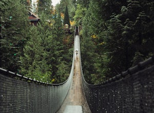
Explore the Capilano Suspension Bridge
3.8This is a great place to visit to get a feeling for the outdoors of Canada. The bridge is a little scary when a lot of people are walking across, but it is well worth the look.Measuring 140 m (460 ft) long, the bridge crosses over the Capilano River in the District of North Vancouver, British Col...Read more -
Vancouver, British Columbia
Explore Wreck Beach
4.0Located on UBC Vancouver campus, Wreck Beach is the only nude beach in Canada. It is a popular destination for students and the public, and is home to the best sunsets seen in Vancouver.To get to the beach, there is a descent of approximately 500 stairs, so be cautious - going down means having t...Read more -
North Vancouver, British Columbia
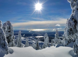
Snowshoe Mt. Seymour to Tim Jones Peak
5.6 mi / 1607.6 ft gainYou'll see traction of all sorts in the Mt. Seymour area during Winter months, including: yak tracks, microspikes, crampons, snowshoes, skis (with and without skins), and my personal favourite, the magic carpet.The Mt. Seymour trail parallels the Seymour downhill ski area. It follows up and over...Read more -
Maple Ridge, British Columbia
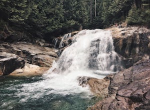
Hike to Lower Falls in Golden Ears Provincial Park
5.03.5 miLower Falls is found within Golden Ears Provincial Park in British Columbia. Easily accessible from the Gold Creek Parking lot, it is a relatively flat trail snaking along Gold Creek itself. It can be done as an out & back trail, or you can make it a loop by using the connector trail located ...Read more -
Maple Ridge, British Columbia
Hiking Upper Gold Creek Falls
4.5Once you arrive in Golden Ears Park, follow the road to the end and look for signs to the Gold Creek Day Area. The road will turn to gravel, and after you cross a small, one-line bridge, you will reach the parking lot.After you have parked, head north past the yellow gate, marked East Canyon Trai...Read more -
North Vancouver, British Columbia
Photograph the Cleveland Dam
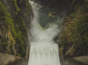
4.0Once you park in the parking lot near the dam, its fairly easy to tell where it is, and how to get there. The awesome spillway looks like one of the worlds most dangerous slides, (don't slide down it), and Capilano Lake and the peaks of the Lions make for a great backdrop in North Vancouver. Ph...Read more -
West Vancouver, British Columbia
Hike Up Brothers Creek Loop
4.3 mi / 1312.3 ft gainThe directions to get to this location are a bit scattered as you need to weave through the upper streets of the British Properties. Driving Instructions If you are coming along Highway #1, take the Taylor Way exit and turn right (coming from the east) or left (coming from the west) onto Taylor W...Read more -
Olga, Washington
Hike the Sound View Trail
0.4 mi / 50 ft gainObstruction Pass State Park is something of a hidden gem on Orcas Island given that its nearby neighbor, Moran State Park, gets most of the tourist attention. What this means is that you can find solitude and quiet, *and* make a visit to the only publicly owned beach on the island. There are seve...Read more -
Olga, Washington
Hike the Highlands Trail
1.5 mi / 200 ft gainObstruction Pass State Park is something of a hidden gem on Orcas Island given that its nearby neighbor, Moran State Park, gets most of the tourist attention. What this means is that you can find solitude and quiet, *and* make a visit to the only publicly owned beach on the island. There are seve...Read more -
Olga, Washington
Camp at Obstruction Pass State Park
5.0The nine primitive campsites and one Cascadia Marine Trail campsite of Obstruction Pass State Park are the only first come, first serve campsites available on Orcas Island. The campsites themselves overlook a fantastic (and accessible beach) and Obstruction Pass itself. There are four composting ...Read more -
Bellingham, Washington
Hike to Fragrance Lake
4.75.5 mi / 950 ft gainTake Chuckanut Drive to the trailhead which is located directly across from the entrance to Larrabee State Park. A small lot in front of the trail has space for 8-10 cars, or you can park at the State Park and walk across the road (carefully!) to reach the trailhead. Either way you will need a Di...Read more -
Friday Harbor, Washington
Hike to Lovers Leap on Stuart Island
5 mi / 200 ft gainThis hike is only doable if you are already on Stuart Island! There is no public transportation to Stuart Island, so you must already be there or have a plan to be there in order to complete this hike.I frequent this island during the summer months and it is one of my favorites. I always stay in ...Read more

