British Columbia
Explore the lush rainforests, vast mountain ranges, and wild backcountry of British Columbia. Whether you're skiing along the Powder Highway, climbing in the Bugaboos, or venturing into the endless and untamed landscapes of Northern BC, there are adventures to be found everywhere.
Top Spots in and near British Columbia
-
Fraser-Fort George F, British Columbia
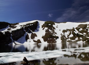
Hike to Raven Lake
4.56.2 mi / 1476.4 ft gainTo reach the trailhead travel east from Prince George on Highway 16. At 88 km turn right onto Hungary Creek Service Road. Travel 13 km on the main road and turn right at the junction (keep your eye out for the sign). From here there its only 3 km to the parking lot.Right off the start the trail c...Read more -
Maple Ridge, British Columbia
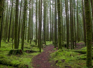
Stroll along the Spirea Nature Trail
3.01.5 mi / 0 ft gainAn hour outside of downtown Vancouver lies the beautiful 150,000 acre Provincial Park of Golden Ears. The park has a myriad of hikes and adventures all with varying degrees of difficulty. The Spirea Nature Trail likely clocks in as one easiest amongst the dozens within the park. However, don’t le...Read more -
Fraser Valley D, British Columbia
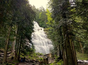
Explore Bridal Veil Falls in Chilliwack
4.00.5 mi / 164 ft gainLocated only a short distance from the Trans-Canada highway is the Bridal Veil Falls Provincial Park. The park is a great area for a picnic lunch, but the highlight of the park is the almost 200 ft. (60 meter) waterfall. The location of the park and the duration of the hike to the waterfall make ...Read more -
Whistler, British Columbia
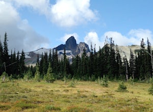
Hike to Helm Lake
4.012.4 mi / 3000 ft gainHelm Lake is a sparkly body of water tucked into one of the most scenic alpine meadows around. The lake sits on a lava field, just under the Black Tusk, with the unique volcanic remains of Cinder Cone and Helm Peak on the opposite side of the meadow.The big draw for this hike is that it's far les...Read more -
Ucluelet, British Columbia
Hiking Willowbrae to Halfmoon Bay and Florencia Bay
The Willowbrae trailhead is not marked along the Tofino Ucluelet highway and the turnoff is easy to miss. Driving from Tofino look for Willowbrae Road on the right hand side, 2 kilometers past the Port Alberni junction. From Ucluelet this road is on the left, 5 kilometers from town. Drive up...Read more -
Hope, British Columbia
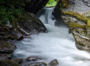
Hike to Flood Falls, British Columbia
5.00.6 mi / 262.5 ft gainYou can see the waterfall up high cascading down to the ground from where you park. Once you get to the trailhead and park on the side of the road, follow the trail toward the waterfall. The trail is a bit rough in spots with lots of roots, so be careful where you step. On the way to the falls, t...Read more -
Yale, British Columbia
Hike & Swim at Falls Lake, BC
3.0Usually the Coquihalla is a means of a way to get from Point A to Point B, but why drive past all that rugged B.C. beauty? Skip the usual travel rest stops and have a micro adventure while passing through the transition zone between B.C.'s coastal and interior landscapes.The trailhead is 1km (0.6...Read more -
Comox-Strathcona C, British Columbia
Hike to Cruikshank Canyon Lookout
5.012.4 mi / 2854.3 ft gainTravelling through pristine sub-alpine terrain, and past endless crystal clear lakes, the trail to the lookout is loaded with awesome scenery. The icing on the cake is reaching the Canyon and enjoying lunch at the lookout, complete with Whiskey Jacks and 180 degree mountain and valley views. If...Read more -
Penny, British Columbia
Hellroaring Falls
5.00.84 mi / 66 ft gainOnce you are at the trailhead, the hike to the falls is relatively short. The first section of the trail is a bit overgrown with devils club. I would recommend wearing pants and not shorts. There is a steep hill at the beginning, with a rope for assistance and then the trail quickly levels out. T...Read more -
Fraser Valley D, British Columbia
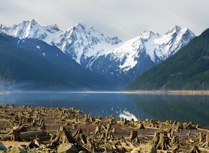
Paddle on Jones Lake, BC
5.0Jones Lake Reservoir is approximately 25 km southwest of the town of Hope, British Columbia. Directly off of BC Highway #1 at the community of Laidlaw. To reach the lake, you will have to drive 9 km (5.6 mi.) on a steep and pretty beat up gravel road. The Jones Lake Forest Service Road is car ac...Read more -
Field, British Columbia
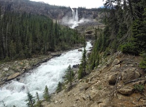
Twin Falls via Yoho Valley Trail
4.010.92 mi / 2274 ft gainAn 18 km hike with approx 300 m elevation gain, with good variety, several waterfalls, Twin Falls themselves, Twin Falls Tea House (especially if it's open), a walk through a rock field with great views, a dried up lake bed. Start at the Takakkaw Falls parking lot and follow the well marked trai...Read more -
North Vancouver, British Columbia
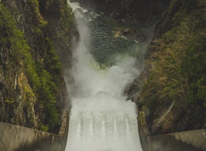
Photograph the Cleveland Dam
4.0Once you park in the parking lot near the dam, its fairly easy to tell where it is, and how to get there. The awesome spillway looks like one of the worlds most dangerous slides, (don't slide down it), and Capilano Lake and the peaks of the Lions make for a great backdrop in North Vancouver. Ph...Read more -
Columbia-Shuswap B, British Columbia
Hike to Miller and Eva Lakes in Mount Revelstoke NP
4.09.3 mi / 587.3 ft gainMount Revelstoke, located in the Columbian Range on the border of Alberta and British Columbia, is the only summit in the Canadian Rockies you can reach by car. The windy road from the Trans-Canadian highway rises about 4000 ft. offering increasingly expansive views of the valley below. The park ...Read more -
Comox-Strathcona D, British Columbia
Hike to Flower Ridge
20 mi / 5445 ft gainWith a name like Flower Ridge, who wouldn't want to add this hike to their bucket list?The Flower Ridge trailhead is located approximately 26kms down the Buttle Lake Parkway, towards Westmin Mine, in Strathcona Provincial Park. A classic Island alpine approach, you will be more than warmed up af...Read more -
Britannia Beach, British Columbia
Rock Climb at Seal Cove
From the Britannia Beach parking lot walk north. There is a well established trail along the West side of the highway. Walk roughly 400 metres North and you will find a steep trail leading towards the ocean. You'll quickly come to a small boulder field, cross cautiously and follow the cairns. Fr...Read more -
Nanaimo F, British Columbia
Summit Mt. Cokely via the Historic CPR Trail
5.012.4 mi / 1000 ft gainThe trail from Cameron Lake to the top of Mount Cokely (5302') provides the most ready access to the alpine on Southern Vancouver Island. The route is straightforward and non-technical, albeit physically challenging. Expect to spend 6-8+ hours if hiking the entire route described below (which we ...Read more

