Climb Mt. Wakefield
Tasman River, New Zealand
Details
Distance
3 miles
Elevation Gain
4593.2 ft
Route Type
Out-and-Back
Description
Added by Kyle Obermann
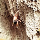
Mt. Wakefield is an epic day hike in the Mt. Cook area that unforgivingly cuts along scree ridgelines on the peaks between the Tasman and Hooker valleys. Not for the inexperienced or those afraid of heights, navigate these craggy ridges with the Tasman, Mueller, and Hooker glaciers below, the azure waters of Pukaki twinkling in the distance, and the peak of Mt. Cook always soaring elusively above. This route is a must-do for experienced adventurers.
The route begins on Tasman Valley Road right after it crosses over the Hooker River heading towards the Tasman Valley. Right after the bridge at Hooker corner there will be a small cutoff on the left side (as you head towards the Tasman). This gravel cutoff is where the trail starts up Mt. Wakefield and you can park your car (no camping allowed).
The first hour or so is a battle up through thick scrub which is made even tougher if the ground is wet. Afterwards, you emerge to your first views of the Tasman and a scrubby trail marked by cairns will lead you up to the ridge. Here, it narrows off to become a rocky, scree ridge undulating and twisting all the way to the summit. While in most places the rock is fairly stable, the ridge is very exposed so you must have fair weather and good scrambling skills to do this.
There are two possible summits on this route depending on your time/experience. The shortest and easiest option is to reach the cairned, unnamed summit at 1,717m which is straight south from the main peak with a basin opening up before you. From here you have the option of following the ridge or cutting across the basin below to reach the peak of Wakefield (2058m). Most people stop at the first summit, and for those short on time or who lack experience this is probably a good option (the hike up to this point alone is quite challenging and you need to be comfortable with route finding and heights – inexperienced people have gone off route and become “bluffed” here before).
If you don’t want to do an out-and-back there is also a route heading down from the peak into the Hooker valley for experts. Head to the Mt. Cook DOC to gather more information about this option. This is a map of the route.
Download the Outbound mobile app
Find adventures and camping on the go, share photos, use GPX tracks, and download maps for offline use.
Get the appFeatures
Climb Mt. Wakefield Reviews
We bivvied overnight just below the first unmarked summit and came down the following morning. Made for a great sunset. There are definitely some exposed sections of ridge and lots of loose rock so you need to be comfortable with that. The good thing is this climb/hike gradually gets harder and if you find yourself getting out of your comfort zone, just turn back!
4.0
Leave No Trace
Always practice Leave No Trace ethics on your adventures and follow local regulations. Please explore responsibly!
Nearby
Rock Climb at Unwin Crag
Hike to Muller Hut
Catch the Sunrise at Kea Point
Climb Mt. Ollivier
Climb to Mueller Hut
Hike to Hooker Lake
Community
© 2024 The Outbound Collective - Terms of Use - Privacy Policy


