United States
Looking for the best backpacking in United States? We've got you covered with the top trails, trips, hiking, backpacking, camping and more around United States. The detailed guides, photos, and reviews are all submitted by the Outbound community.
Top Backpacking Spots in and near United States
-
Bluemont, Virginia
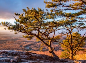
Hike to Bears Den Overlook
4.41.31 mi / 164 ft gainBears Den is a collection of rocks and boulders that overlooks the Shenandoah Valley in northern Virginia, just off the Appalachian Trail. You have two options to access this overlook: park at the bottom of the mountain and hike up to the overlook via the trail, or drive to the top and access the...Read more -
Leavenworth, Washington
Evergreen Mountain Lookout
4.52.88 mi / 1522 ft gainThis is a relatively short hike, at only 2.6 miles round trip, that takes you up to the nearly 5600 foot summit. The hike may be short but it is extremely steep, gaining 1300ft in the 1.3 miles to the summit, so be prepared for a good leg workout. On the way to the top you will walk through field...Read more -
Morganton, North Carolina
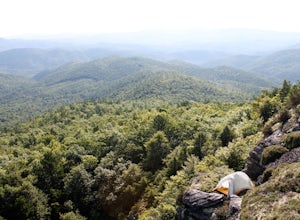
Hawksbill Mountain Trail
4.91.87 mi / 633 ft gainHidden far above the beautiful Linville Gorge stands Hawksbill Mountain, among many other fantastic hikes. The roughly 1.7 mile hike from the dusty gravel parking lot is steep but worth every step. It took me about an hour to conquer with a few water bottle-guzzling stops. At the top, you are al...Read more -
Burnet, Texas
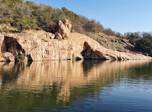
Camp at Inks Lake's Pecan Flats
5.02 miInks Lake is located northwest of Austin and is home to about 200 campsites. For a more unique experience and to be set away from the parks many visitors, choose the Pecan Flats Trail Primitive Camp which is about a mile hike from the Pecan Flats trailhead.Once you enter the park, the Pecan Flats...Read more -
Alta, Wyoming
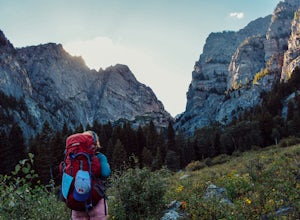
Death Canyon to Fox Creek Pass
5.018.15 miDay 1: This trip begins at the Death Canyon Trailhead. Try to arrive early, as it gets crowded and various groups day hike from here. After the first few miles, you’ll encounter Phelps Lake. You’ll have several opportunities for photos, and they will all be beautiful. As you continue on, be on t...Read more -
Azusa, California
Little Jimmy Trail Camp
4.33.36 mi / 607 ft gainTake Hwy 2 out of La Canada north along Angeles Crest Highway. Follow this for quite some time enjoying the fine views in all directions. After traveling through two consecutive tunnels continue to the Islip Saddle parking lot (on left). There will be a vault toilet & a picnic table. Display ...Read more -
Skykomish, Washington
Tank Lakes via Necklace Valley
18.94 mi / 4721 ft gainTucked high in the heart of the Alpine Lakes Wilderness, Tank Lakes has everything you could ask for out of a Washington hike. You start low at the Necklace Valley trailhead just south of Skykomish along Highway 2 and meander five miles to a giant log crossing of the East Fork Foss River. From h...Read more -
Kanab, Utah
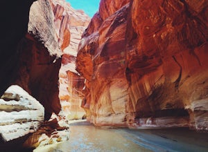
Hike through Paria Canyon
5.014.94 mi / 846 ft gainNo matter how far you plan on hiking, it is ideal to get an early start so you aren’t hiking too long under the desert sun. There is no shade on this hike except for the shadows offered from the steep walls of the canyon, so make sure you bring sunscreen! From the very start, you’ll get your fee...Read more -
Sparta, Tennessee
Virgin Falls State Natural Area Loop
5.04.46 mi / 400 ft gainBeginning at the Virgin Falls SNA parking area, the Virgin Falls trail is approximately a 9 mile round trip (excluding any side trails) which will allow you to experience three waterfalls: Big Branch Falls, Big Laurel Falls, and the namesake Virgin Falls. There is a fourth, Sheep Cave Falls, that...Read more -
Bryce, Utah
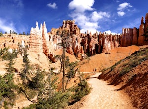
Navajo Loop and Queens Garden Trail
4.92.93 mi / 679 ft gainThere are many many trails that explore the hoodoos of Bryce Canyon and this is just one option of a combination of trails that is about 3.5 miles. The Navajo trail begins at Sunset Point and you head straight down dozens of switchbacks to what is called "Wall Street". It doesn't take long to get...Read more -
Luray, Virginia
White Oak Canyon to Upper Falls
4.84.28 mi / 866 ft gainBetween mile 42 and 43 of Skyline Drive in Shenandoah National Park is the trailhead for WhiteOak Canyon. Begin at the trailhead from the parking lot and cross the Limberlost Trail in .3 miles. Continue on and you will cross your first footbridge shortly. After another mile you will cross the s...Read more -
Big Sur, California
Salmon Creek Trail to Spruce & Estrella Camps
4.56.07 mi / 1919 ft gainFeel free to hike Salmon Creek Trail at your own pace – you can choose to turn back at any point, or at the Spruce (2 miles in) or Estrella (3.25 miles in) sites. The trail leads to open vistas of the coast, giving stunning views of the cliffs and ocean. Around 2 miles in, follow the fork to the...Read more -
Bend, Oregon
Tam McArthur Rim, Green Lakes, Park Meadow Tie Loop
3.322.58 mi / 3675 ft gainThis loop trip around Broken Top is one of the premier backpacking loops in Oregon. The trail winds past numerous alpine lakes, including the popular Green Lakes area, and offers near-constant views of Broken Top, the Three Sisters, and Mount Bachelor. To top it all off, the clear skies typical o...Read more -
Dillon, Colorado
Silver Dollar Lake Trail
5.03.93 mi / 945 ft gainGuanella Pass, which connects the charming and historic town of Georgetown in the north to the blink-and-you’ll-miss-it Grant to the south, is a recreational outdoorsman’s dream. Volumes could be written on what this 22-mile scenic byway has to offer. Silver Dollar Lake Trail is just one tiny po...Read more -
Mariposa County, California
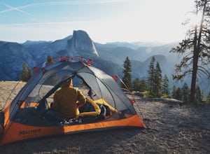
Camp at Glacier Point
4.79.17 mi / 3491 ft gainEveryone that knows Yosemite, knows Glacier Point. An overlook that attracts thousands of people per day that drive up via Glacier Point Road is rarely vacant of the hustle and bustle of people. However, there is a loop hole here, and when the stars align you can have Glacier Point ALL to yoursel...Read more -
Mesick, Michigan
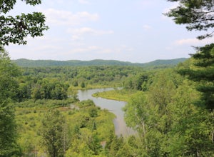
Backpack the Manistee River Trail
4.017.6 miStarting at the Red Bridge River Access Area just off North Coates Hwy (about 8 miles east of Brethren, Michigan) there is a small parking lot opposite of the trailhead where you can leave your car. The trail is part of the North Country Trail (NCT) so it is well marked with signs leading the way...Read more

