Castro Valley, California
Looking for the best hiking in Castro Valley? We've got you covered with the top trails, trips, hiking, backpacking, camping and more around Castro Valley. The detailed guides, photos, and reviews are all submitted by the Outbound community.
Top Hiking Spots in and near Castro Valley
-
San Francisco, California
Batteries to Bluffs Trail
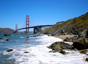
4.82.33 mi / 417 ft gainThe Batteries to Bluffs Trail in the Presidio is a true gem of San Francisco. It has everything you could want in a hike: a sea-side path along the ocean, relatively easy parking, gorgeous views of the Golden Gate Bridge, and a secluded beach that's perfect for picnics, sunbathing, and enjoying t...Read more -
Pacifica, California
Mori Point Loop
4.82.54 mi / 276 ft gainStart at the parking lots close to the pier, where bathrooms are also available. Walk along the pier to watch the sunset as it begins. Next, walk along Sharp Park Beach to discover the plethora of wild flowers and friendly locals always ready to guide you on your walk. Take the stairs up to the...Read more -
Pacifica, California
Montara Mountain Trail
5.06.77 mi / 1900 ft gainMontara Mountain Trail is a loop trail that takes you through a forest out to ocean views at the top of Montara Mountain. This hike located near Pacifica, California. and can be accessed from Highway 1 as well. If you're looking to do a similar loop hike from the coast, consider Montara Mountain ...Read more -
San Francisco, California
Fort Funston Trail
4.71.81 mi / 253 ft gainFort Funston is an SF gem I discovered when looking for a dog friendly hike near the city. Located west of Lake Merced, you'll find a gorgeous Northern California beach oasis where you and your dog can run wild and free :). Parking is located at the top of the park where you'll descend a steep se...Read more -
Livermore, California
Hike to Murietta Falls
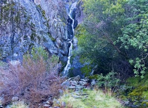
4.012 mi / 4175 ft gainGet ready for one of the toughest, lung busting hikes in the east bay with over 6-miles and 4,000ft of climbing in one direction. When you make it to the hike, it's also important to realize that without recent rain, there many not actually be a waterfall. With that said, you're still getting in ...Read more -
San Francisco, California
Lands End Trail
4.73.26 mi / 500 ft gainThe Lands End Trail is a 3.26 mile out-and-back hike located in the northwest corner of San Francisco along the city's rugged coastline. Offering spectacular views of the Golden Gate Bridge, Marin Headlands, and the Pacific Ocean, the hike is one of the most popular trails in San Francisco for ...Read more -
San Francisco, California
Mile Rock Beach
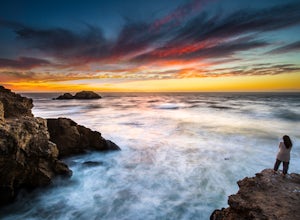
4.71.64 miThis rocky, secluded beach is tucked in along the Land’s End Coastal Trail in the Golden Gate National Recreation Area. Located 100 or so steps down from the main trail, you’ll find this mysterious little beach that will make you feel like you’re in an old pirate movie. There are a lot of logs an...Read more -
Redwood City, California
Hike or Bike the Old Growth Redwood Loop at El Corte de Madera
4.48.8 mi / 1900 ft gainThis hike starts at the middle parking lot of the El Corte de Madera Open Space Preserve. The middle lot is located roughly a mile south on Skyline Boulevard from the Skeggs Point Vista. From the parking lot, take the Methuselah Trail for 0.3 miles until you reach the Timberview Trail. Take this ...Read more -
Portola Valley, California
Hike the Windy Hill Loop
4.37.2 mi / 1400 ft gainThis 7.2-mile loop starts by heading out of the parking lot and onto the Spring Ridge Trail. Head Southeast On Spring Ridge Trail until you connect with Hamms Gulch Trail. When you jump on Hamms Gulch, head southwest for ~3.4 miles as you circle the far end of the OSP. At this point, you will con...Read more -
Los Altos, California
Park Day at Foothills Park
1.7Disclaimer: Foothills Park requires proof of residence in Palo Alto or being accompanied by a resident of the city. Learn more here.Foothills Park is 2.7 miles west of 280 after exiting Page Mill. After exiting you take a short scenic drive up the hill and come to the park entrance on your right...Read more -
Half Moon Bay, California
Purisima Creek Trail and Craig Britton Trail Loop
4.06.95 mi / 1411 ft gainThis hike is perfect for any time of year, always staying cool because it is near the coast, and there are multiple creeks that flow year-round. Even on foggy days, the fog condenses on trees to make it seem like it is "raining." Be warned that this hike has a lot of elevation change and is stre...Read more -
Sausalito, California
Battery Spencer
4.00.47 mi / 46 ft gainThis is a very popular spot to hike up to from Conzelman Road. You can find parking in the lot or on the street and do the quick hike up to Battery Spencer. You can get a perfect view of the Golden Gate Bridge and SF from the Marin side of the Bay. This is a unique perspective as you also get the...Read more -
Mill Valley, California
Kirby Cove
4.72 miThis scenic hike is a 1.8 mile out-and-back trail located near Sausalito, CA. From the trail and beach, you'll get scenic of the Golden Gate, San Francisco's skyline, and glimpses of the East Bay. The best news, there's rarely any crowd. Consider packing a blanket and a small picnic. With panora...Read more -
Santa Clara County, California
Black Mountain via Rhus Ridge Trail
9.75 mi / 2992 ft gainJust outside of Los Altos is a very long ridge of mountains, one of which is Black Mountain. This is a very dry hike, with no tree canopy, so it can get very hot! Be aware that this can make the hike feel a lot more difficult with the sun beating down on you. Follow Rhus Ridge Trail to Black Mo...Read more -
Portola Valley, California
Sunrise Hike at Windy Hill
5.0There are a few options to this hike. Usually I would recommend parking in the lot on Portola Road, but because the preserve doesn't open until 30 minutes before sunrise, it's best to park up on Skyline Boulevard (Highway 35). There are two places to park up on Skyline, but the main parking lot i...Read more -
Sausalito, California
Ninja Loop
9.37 mi / 1831 ft gainThis loop can start from several different locations, including Rodeo Beach and the Golden Gate Bridge parking lot. Starting from the GGB will add 2 more miles onto this run. I like to start at the Coastal Trailhead parking lot off of McCullough and Conzelman Roads (just a notch down from Hawk Hi...Read more

