Malibu, California
Looking for the best hiking in Malibu? We've got you covered with the top trails, trips, hiking, backpacking, camping and more around Malibu. The detailed guides, photos, and reviews are all submitted by the Outbound community.
Top Hiking Spots in and near Malibu
-
Burbank, California
Vital Link Trail
4.03.72 mi / 1775 ft gainFrom I-5, take the Burbank Blvd exit. Drive north on Burbank Blvd. and take a right on N 3rd. Left on E Harvard. Right on Wildwood Canyon after 1.5 miles. There are a few ways you can begin your hike: from the parking lot, the entrance will be to the left past the gate. Here you were have a stee...Read more -
Burbank, California
Wildwood Canyon Loop
3.98 mi / 1680 ft gainThe Vital Link Trail is a steep and narrow out-and-back trail accessed though the Wildwood Canyon Park located in Burbank, CA. Parking at Wildwood Canyon is free and easy, and will be determined by which of the four trailheads you choose to start from. For the shortest and most direct route you...Read more -
Los Angeles, California
Elysian Park
4.01.88 mi / 282 ft gainThe trail at Elysian Park in Los Angeles, California, is a moderate difficulty hike that spans approximately 1.88 miles. The trail is well-marked and offers a variety of terrain, including dirt paths and paved roads. The trail is known for its panoramic views of the city, including the iconic Dod...Read more -
Glendale, California
Brand Library Loop
5.06.56 mi / 2648 ft gainYour adventure will start at the Brand Library parking lot. Walk behind the library towards the gated day use area and you will find the start of the trail on your right, Las Flores MTWY. The first half-mile rises over 500 feet to a plateau, equipped with benches, a park map and views of Griffit...Read more -
Los Angeles, United States
Verdugo Crest Trail
4.06.71 mi / 2510 ft gainThe Verdugo Crest Trail is a 6.6 mile loop near Glendale, California. The trail features lovely wildflowers in the spring and beautiful views year-round. The trail is steep, so make sure you are wearing sturdy running or walking shoes. Dogs are allowed on the trail but must be kept on leash. Va...Read more -
Santa Paula, California
Santa Paula Punch Bowls
3.66.5 mi / 1037 ft gainThis is a 6.5 mile trail, out and back. Parking is available along Ojai St, and the trail starts at the entrance of Thomas Aquinas College. Follow the paved road that goes around the school, until you reach a fork on the road, then stay right. The trail will take you through Ferndale Ranch, just ...Read more -
Los Angeles, California
Secret Swing in Elysian Park
4.20.16 mi / 360 ft gainFor the most direct directions to the swing, plug in "Swing on top of Elysian Park" into google maps, which will take you directly to the trailhead. If you want to do it the more old fashion way, the swing is on top of a hill at the intersection of Angels Point Drive and Park Row Drive in Elysian...Read more -
Los Angeles, California
Verdugo Peak via Hostetter Fire Road
5.07.39 mi / 1627 ft gainVerdugo Peak, at 3000 feet, is accessible from multiple directions and trails along the Verdugo Range. The most direct route to the top is Hostetter Fire Road, a 3.6-mile hard-packed dirt trail that climbs 1600 feet to the 3,126-foot summit. The hike begins at the dirt parking lot off of La Tuna ...Read more -
Glendale, California
Mt. Thom and Tongva Peak
6.06 mi / 1480 ft gainMount Thom and Tongva Peak are accessed by using the 6.2 mile out and back trail, Las Flores Motorway located in the north part of Glendale, CA. Roadside parking is not allowed near the trailhead, you will need to park in the nearby residential area along Sunshine Drive about 0.15 miles away from...Read more -
Glendale, California
Beaudry Loop
5.79 mi / 1572 ft gainThe Beaudry Loop trail features a bench at the top with 360 degree views of the greater LA area. The trailhead is a little hidden on Beaudry Blvd. As Beaudry Blvd turns into Beaudry Terrace, you'll see cars parked at the paved trailhead. There is very little shade on the trail so bring ample sun...Read more -
Los Angeles, California
City View and Walnut Forest Trails Loop
4.02.59 mi / 568 ft gainThe City View and Walnut Forest Trails in Ernest E. Debs Regional Park are just outside of downtown Los Angeles, and are perfect for all abilities. The trails are most commonly used by dog walkers, trail runners, mountain bikers and families. The top of the hike features a unique pond. Dogs are a...Read more -
Los Angeles, California
Sunset Hike in Ascot Hills
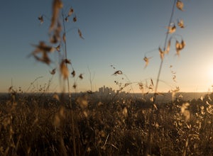
3.5Ascot Hills Park is a great hidden gem located a few miles east of Los Angeles. There is a parking lot with plenty of parking but the gates close at sunset, which is a great time to go, so if you plan on staying later, park outside the gates where there is ample street parking. Depending on the s...Read more -
Castaic, California
Paddle Castaic Lake State Recreational Area
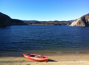
6 miCastaic Lake is a man made reservoir located 41 miles north of downtown Los Angeles, CA in the town of Castaic. Made up of two bodies of water, separated by a 425-foot dam, Upper and Lower Castaic Lakes have a combined 29 miles of shoreline forming the Castaic Lake State Recreational Area. The s...Read more -
Los Angeles County, California
Trail Canyon Falls
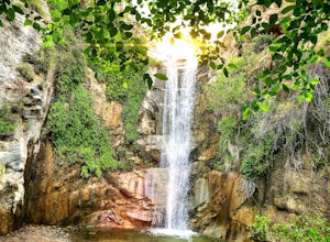
4.04.56 mi / 1017 ft gainTo get to the trail, take Big Tujunga Canyon Road until you see signs for Trail Canyon Road. The entry point is easy to miss, but keep an eye out for a stop sign and cars parked at the bottom of a dirt path. Drive up the dirt path for direct parking at the trailhead (4x4 is definitely recommended...Read more -
Pasadena, California
Arroyo Terrace Trail
5.01.54 mi / 194 ft gainArroyo Terrace Trail is a loop trail that takes you by a river located near Pasadena, California.Read more -
La Cañada Flintridge, California
Teepee Trail
5.02.55 mi / 1145 ft gainHidden in the small community of La Canada, California, the trailhead is pretty hidden! From the 210, take the exit for Highway 2/Angeles Crest Highway. Head north (towards the mountains) for about a mile. As the highway begins to curve, you will come across a small side-street, Harter Lane. Turn...Read more

