Malibu, California
Looking for the best hiking in Malibu? We've got you covered with the top trails, trips, hiking, backpacking, camping and more around Malibu. The detailed guides, photos, and reviews are all submitted by the Outbound community.
Top Hiking Spots in and near Malibu
-
Ventura, California
Smuggler's Cove
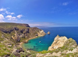
3.57.72 mi / 1342 ft gainSave one stretch of elevation close to the cove itself, this 8-mile, round-trip hike is a leisuring trek across one of the countries most beautiful, though less famous National Parks - the Channel Islands. Smuggler's Cove is located on the Santa Cruz Island, which also happens to be the largest i...Read more -
Ventura, California
Potato Harbor via North Bluff Trail
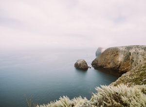
4.49 mi / 463 ft gainThe 4.5-mile North Bluff Trail traverses the colossal cliffs of Santa Cruz Island in Channel Islands National Park from Scorpion Anchorage to Potato Harbor. Arrive via an Island Packers boat to Scorpion Anchorage and, upon disembarking, walk straight ahead. Just past the restrooms (one of only tw...Read more -
Avalon, California
Visit Two Harbors, Catalina Island
5.0Just 30 miles from the commotion and congestion of Los Angeles, is a small island village that time seems to have left behind. You won't find the usual traffic, development, and big crowds here. You won't find movie theaters, concert venues, hotels, nightclubs, or sporting events either. At Cata...Read more -
Ventura, California
Scorpion Ranch Campground
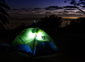
4.00.72 mi / 43 ft gainAccessible only by Ferry, this little-known national park is a backpacker's dream. You can catch the ferry out of Ventura or Santa Barbara, only a short distance from LA. The ride to the island is around 1 hour. We chose to take Island Packers Ferry out of Ventura to Santa Cruz Island. The ferry...Read more -
Ventura, California
Kayak Santa Cruz Island
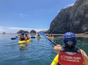
4.5As the largest of the Channel Islands, Santa Cruz Island in the Channel Island National Park is an ecological treasure, and to kayak it is to get to experience it in a manner unlike any other. Getting to the island is easiest through Island Packers where you can also reserve a kayak (so pack effi...Read more -
Ventura, California
Potato Harbor Trail
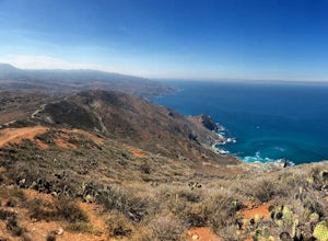
5.04.34 mi / 404 ft gainAs California’s largest island, Santa Cruz Island of the Channel Islands is the perfect little getaway from Los Angeles. Getting to the island is possible only by a one hour boat ride through Island Packers, click here to find out more about them. Be sure to pack light since you’ll be carrying ev...Read more -
Ventura, California
Cavern Point & Potato Harbor Loop
4.99 mi / 545 ft gainTucked away in the Pacific Ocean just 25 miles from the coast, the Channel Islands are one of Southern California’s hidden gems. With towering cliffs and isolated beaches that hug the coast, this place makes you feel worlds away from home. Channel Islands National Park is comprised of five island...Read more -
Two Harbors, California
Day Hike across Catalina: Two Harbors to Avalon
21 miThis hike was one of the most difficult and definitely one of the most memorable hikes I’ve ever done. The view of the island and the surrounding water is surreal and I am yet to be anywhere like this hike. The dry California vegetation of the mountains matched with the bright blue endless backgr...Read more -
Avalon, California
Camp at Catalina's Two Harbors
4.8An island camping escape is a mere 50 minute boat ride away from the southern California coast. If you're feeling generous with your funds, you can also opt for a helicopter ride, leaving out of Long Beach and 15 minutes later landing in Catalina Island.Two Harbors campground is unique with the a...Read more -
Whittier, California
Sycamore Canyon Trail in Turnbull Canyon
2.03.47 mi / 627 ft gainThe Sycamore Canyon Park Trailhead can be found at the end of the dirt parking lot off Workman Mill Road. The entrance is off a small road which is pretty easy to miss, but there is a sign off the main road. Soon after you start on the trail, the path opens up onto a larger dirt road for vehicle ...Read more -
Ojai, California
Piedra Blanca Formations
5.05.41 mi / 860 ft gainThese white sandstone formations, splitting out of the forest, are a worthwhile sight as you climb up to gain a great vantage point of the valley. Spend some time exploring the rocks - the nooks & crannies are full of surprises. You can turn this into an overnighter by staying at the campgrou...Read more -
Ojai, California
Willett Hot Springs via Sespe River Trail
20.08 mi / 2598 ft gainPark at the Lions Camp parking lot. Adventure Passes aren't technically "required" but it never hurts to have one. You can stop at the Forest Service in Ojai (1190 E. Ojai Ave) or stop at the Wheeler Gorge Station on your way up to buy one for $5 for a night. The trail begins at the far side of t...Read more -
Agua Dulce, California
Vasquez Rocks
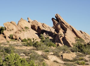
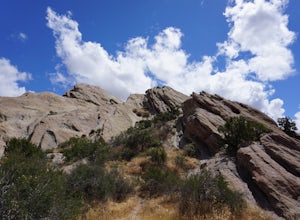
5.02.42 mi / 367 ft gainThis is a Natural Park Area located in Santa Clarita, within the Sierra Pelona Mountains. It features amazing diagonal rock formations, created because of the force between two tectonic plates pushing against each other. This place is a photographer's paradise, and every spot in this 900+ acre l...Read more -
Santa Clarita, California
Hike the PCT and Foot Trail Loop through Vasquez Rocks
5.05.5 mi / 287 ft gainThe Pacific Crest Trail and foot trail hike is a 5-mile loop with a quick PCT branch-off that leads under the 14 freeway through a long, well-maintained (but very dark) tunnel. Pull into the well-marked parking lot and stop in the visitor center to take a look at the topographical park model and...Read more -
Los Angeles County, California
Mt. Disappointment via Billy Riley Trail
3.5 mi / 1132 ft gainFrom the 210 Freeway in La Cañada, take California Highway 2 north 14 miles up into the San Gabriel Mountains. Make sure you have your National Forest Pass (sold at REI or Ranger Station) or your Interagency Pass because they have started checking parked vehicles. At the Red Box Picnic area, make...Read more -
Los Angeles County, California
Idlehour Trail
4.014.89 mi / 4665 ft gainIdlehour Trail located near Mount Wilson, California, is an out-and-back trail that is strenuous and can take 8-10 hours if done all at once. There are opportunities to camp off the trail, making this a backpacking trail in the Angeles National Forest as well. To access the Idlehour Campground ...Read more

