Montana
Looking for the best backpacking in Montana? We've got you covered with the top trails, trips, hiking, backpacking, camping and more around Montana. The detailed guides, photos, and reviews are all submitted by the Outbound community.
Top Backpacking Spots in and near Montana
-
Roscoe, Montana
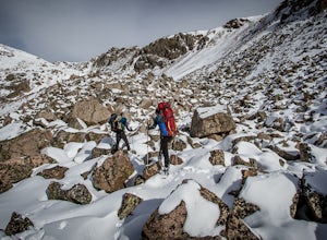
Backpack to the Beartooths
5.014 mi / 7620 ft gainWe stood there, against the wind, looking at 3-4 pitches. The line appeared too good to be true. It was a bit of an ice pitch, followed by a snow coliour, finishing with a pitch of mixed climbing that would take us to the top.I'd heard things about The Beartooths. But, they weren’t validated unti...Read more -
Darby, Montana
Backpack and Summit Trapper Peak
4.08.75 mi / 3327 ft gainFrom Darby, MT, follow MT 473 south for 4 miles to West Fork Bitterroot River Rd. A mile past the Job Corps, at milepost 7, turn right on FS 5634 (Baker Point Rd.). Follow this road 10 miles to the trailhead at about 7000 ft. The trail begins on a FS trail to Baker Lake. There are fish in Baker L...Read more -
West Glacier, Montana
Backpack to Logging Lake
8.8 miBackcountry camping is the best plan if you’d like to visit Logging Lake, and the primitive campsites lay at the end of a four and a half mile hike through some of the most unspoiled sections of the park. The trail follows logging creek most of the way to the lake traversing through a variety of ...Read more -
Browning, Montana
Backpack to the Foot of Glenns Lake
20.6 mi / 950 ft gainStarting from the Chief Mountain Parking Area, take the trail to the left of the bathrooms at the end of the parking lot (left of the bathrooms if you are facing the bathrooms and the main road is to your right). You will quickly hike to a wooden kiosk. Read this kiosk for any pertinent informati...Read more -
Park County, Montana
Backpack the Aero Lakes to Granite Peak
26 mi / 6200 ft gainGranite Peak is considered one of the most difficult state high-points, for its remoteness and its climbing challenge. Unfortunately, the access to this route is very remote. Fortunately, this route to the summer is the easiest way up in terms of the technical climbing challenge. This route, k...Read more -
Condon, Montana
Climb Holland Peak
11 mi / 5200 ft gainAbout 2 mi. south of Condon, MT, take Rumble Creek Road east to Cooney Lookout and park at the trailhead at 4550 ft. Follow the trail for about 1 mi. and after about 100 yards after the third bridge, look for a well worn trail heading up the hill side. Take this steep, hard-packed trail and follo...Read more -
Augusta, Montana
Hike Crown Mountain, Augusta
8 mi / 4200 ft gainLocated an hour and forty minutes east of Great Falls Montana, Crown Mountain is a fun day hike, and you'll see few if any other people. The nearest town is Augusta and a great place to stop for a burger and beer at Buckhorn Bar afterward. From Augusta, head West on Benchmark Road for 20 miles. ...Read more -
Kalispell, Montana
Summit Lake Mountain and Nasukoin Mountain
5.012 mi / 3500 ft gainTo reach the trailhead, travel west on US Hwy 93 for 17.9 mi. and then turn right onto Olney Crossover Rd. This road will continue for 8.8 mi. and then keep left onto NF-115 for 9.7 mi. and the destination will be on the right hand side. There is a parking area where the trailhead begins. From th...Read more -
Flathead County, Montana
Backpack to Link Lake
1.3 mi / 600 ft gainTo reach the trailhead, travel west on US Hwy 93 for 17.9 mi. and then turn right onto Olney Crossover Rd. This road will continue for 8.8 mi. and then keep left onto NF-115 for 9.7 mi. and the destination will be on the right hand side. There is a parking area where the trailhead begins. From th...Read more -
Browning, Montana
Backpack to Cosley Lake
27.2 mi / 475 ft gainThe hike goes through different wooded areas, open fields, and passes by the ranger's ranch. In no time, you will be able to see the aqua blue colors of Cosley Lake, as you approach the campground for the night.The campground has pit toilets and a bear bag hanging station, along with a cooking ar...Read more -
Kalispell, Montana
Backpack to Clayton Lake
9 mi / 1500 ft gainFrom the Camp Misery Trailhead (elev. 5,717 ft) take the left Trail 8 for .6 miles. At the junction continue left for a 1.3 mile gently ascent into Jewel Basin. Nearing Twin Lakes continue left on Trail 7 for .6 miles until you reach Trail 55. Continue right, and make sure that after a short .3 m...Read more -
Lincoln, Montana
Hike the Continental Divide Trail via Roger Pass
2.33 mi / 665 ft gainAfter driving over Rogers Pass more times than I can count, we finally made it a point to stop and check out the Continental Divide Trail No. 440 -- glad we did. If you've driven the pass, you've seen the trail head about 66 miles west of Great Falls -- the wooden stairs off the right side of th...Read more -
Moore, Montana
Stay at The Montana Bunkhouse
2 mi / 500 ft gainThe Montana Bunkhouse is a great place to unplug and enjoy time with friends and family. This two bedroom bunkhouse rests in the foothills of the Big Snowy mountains on the Olsen family ranch an hour from the nearest town. The building was built in 1905 as a community hall, later converted to a ...Read more -
Lewistown, Montana
Conquer the Montana Island Challenge
7.16 mi / 1024 ft gainThe Montana Island Challenge is held every year in August at the Half Moon Ranch located about an hour from Lewistown. The ranch has camping spots and a few bunkhouses available if you'd rather head up the day before instead of getting up at the crack of dawn the day of the race.The challenge con...Read more -
Browning, Montana
Backpack to Poia Lake, Glacier NP
12.8 mi / 1700 ft gainLocated in Many Glacier, the Red Gap Pass trail begins at the Apikuni Falls Trailhead located east of the Many Glacier Lodge (if you're looking to check out the falls before your hike, check out Hike to Apikuni Falls at Glacier National Park). The trail starts at a gradual incline and continue th...Read more -
Flathead County, Montana
Kintla Lake Campground
* The road to this trailhead/lake is closed during the winter. Kintla Lake is one of the lesser explored lakes in Glacier National Park. Located on the west side of the park, it is accessible via an unpaved road from the Polebridge Ranger Station. From the Ranger Station, take a LEFT and contin...Read more

