Tennessee
Looking for the best hiking in Tennessee? We've got you covered with the top trails, trips, hiking, backpacking, camping and more around Tennessee. The detailed guides, photos, and reviews are all submitted by the Outbound community.
Top Hiking Spots in and near Tennessee
-
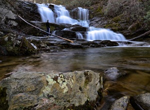
Tellico Plains, Tennessee
Hike to Conasauga Falls
4.51.5 mi / 400 ft gainGetting to the trailhead can be a challenge if there has been any heavy precipitation or icy conditions due to the fact the last two miles are one mile of broken pavement and the last mile a dirt road. You should be fine in good conditions in any car; however, just make sure to take it easy on th...Read more -
Townsend, Tennessee
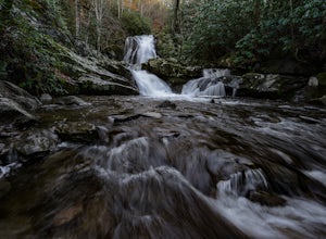
Spruce Flats Falls
4.81.64 mi / 495 ft gainTo get to Spruce Flats Falls, you will want to drive down 2.2 miles down the scenic Tremont Road to the Great Smoky Mountains Institute and park in the visitor center parking area. You will then want to ascend up the gravel road past the sign that says restricted to unrestricted traffic (meaning ...Read more -
Palmer, Tennessee
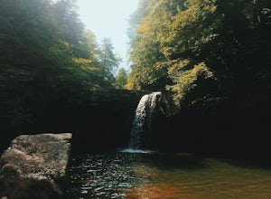
Savage Falls Trail
5.02.98 mi / 495 ft gainSavage Gulf Natural Area has more than 50 miles of trails, so be sure to start this adventure from the Savage Gulf Ranger Station entrance. To the right of the building, you'll find the trailhead for the Savage Day Loop. There, you can begin the 1.8-mile journey to the park's more-secluded waterf...Read more -
Tellico Plains, Tennessee
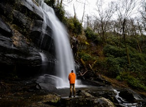
Hike to Falls Branch Falls
5.02.6 mi / 540 ft gainTo get to the trailhead, drive 22.5 miles on the Cherohala Skyway from Tellico Plains, Tennessee. If you are coming from the North Carolina side, drive 20.5 miles to the trailhead. The trailhead parking area is marked by a large green sign saying West Rattlesnake and is surrounded by a low stone ...Read more -
Chattanooga, Tennessee
Hike and Swim at the Middle Creek Slide
3.04 mi / 200 ft gainYou park just west of the map waypoint on the wide shoulder (remember to lock your car, thefts have been reported in this area). The trailhead is really just an opening on the side of the road. Follow this to the creek and start making your way along the rocks upstream. The difficulty of the cl...Read more -
Nashville, Tennessee
Hike the Day Loop at Long Hunter State Park
4.94 miPark at the Bakers Grove Area and take the newly wood chipped wood chip trail into the forest. Cross a small bridge, snake through a rock garden, and pass a sign indicating you are hiking the Day Loop Trail.There will be orange and white blazes. The orange blazes are for the Day Loop and the whit...Read more -
Caryville, Tennessee
Triple Falls AKA Little Egypt
4.01.95 mi / 682 ft gainTriple falls trail otherwise known as little egypt is known for its cooling waterfalls in the summer and fall and the beautiful views from the top of the mountain year round. Getting to it is pretty easy all you have to do is follow your GPS until you see a small dirt parking lot off the side of ...Read more -
Tracy City, Tennessee
Hike the Fiery Gizzard Trail
5.013.5 miStart this journey from the Grundy Forest Trailhead, where you will quickly begin a decent along the Little Fiery Gizzard Creek. At the 0.7-mile split, be sure to turn left and cross the bridge to stay on the Fiery Gizzard Trail. For the next 0.8-mile journey, you'll encounter the gorgeous Black ...Read more -
Dayton, Tennessee
Hike through the Laurel Snow Pocket Wilderness
5.06 mi / 900 ft gainThe Laurel-Snow Trail was the first National Recreation Trail designated in Tennessee and at just under 35 miles from downtown Chattanooga, it is perfect for a day hike, for a day of climbing, or for setting up basecamp for the weekend. The 2,000 acre area sits along the Walden Ridge of the Cumbe...Read more -
Sparta, Tennessee
Hike to Lost Creek Falls
5.00.16 mi / 62 ft gainGPS Coordinates: 35.84102,-85.36123 Why We Love It: NO CROWDS- We only came across a few other people so, it’s a little more low key than some other popular Tennessee waterfalls. DISNEY LOVED IT- This was a filming location for Disney’s 1994 The Jungle Book!CAVE- Across the path there is a lar...Read more -
Greeneville, Tennessee
Hike to Margarette Falls
5.02.7 mi / 715 ft gainTo reach the trail head, take exit number 39 to Erwin/Jonesborough and turn onto State Route 81/107 west and stay on this for 6.5 miles. Then you will turn left to stay on Route 107 and continue on for 16 more miles. Then you will take a left on Route 351 and drive 4.5 miles. Then you will take a...Read more -
Lancing, Tennessee
Camp at OBED Wild and Scenic River Area via the Point Trail
4 miYou will want to park at the Lilly Bluff parking lot. Your GPS won't know where this is, so here are the GPS coordinates N36° 06.162', W84° 43.280'.The trailhead is located on the North side of the parking lot. All you need to do is follow the sign for Point Trail. The trail culminates at an e...Read more -
Tellico Plains, Tennessee
Explore North River Road
4.7If you're looking to get off the beaten path and take the road less traveled, North River Road is your ticket to solitude.A popular loop for the locals is starting on Tellico River Road, then getting on North River Road to make your way up the mountain all the way to the Cherohala Skyway. Take th...Read more -
661-799 Stone Fort Drive, Tennessee
Hike Old Stone Fort Trail
5.02.9 mi / 265 ft gainThe main hiking trail at this small state park follows the wall of Old Stone Fort which was used by the Native Americans as a ceremonial gathering place. The trail threads through dramatic scenery where you can see the original entrance of the fort which was designed to face the exact spot on the...Read more -
Hampton, Tennessee
Hike to Laurel Fork Falls
4.62.6 mi / 600 ft gainFrom Hampton, Tennessee, take US-321S for about 3.5 miles. Turn right onto Dennis Cove Road and travel for 4 miles on this steep and very curvy mountain road. The trailhead is where the Appalachian Trail (AT) crosses the road at a small gravel lot on the left. Take the AT north on the trail lea...Read more -
Gatlinburg, Tennessee
Hike to Clingman’s Dome via Newfound Gap
4.516.6 mi / 1600 ft gainThis route to Clingmans Dome is available throughout the year. But during the winter months from December 1 through March 31, the 7-mile Clingman’s Dome Road that branches off Highway 441 at Newfound Gap, stays closed. This means the usual drive to the parking area located just a half mile below ...Read more

