Amherst, Virginia
Looking for the best hiking in Amherst? We've got you covered with the top trails, trips, hiking, backpacking, camping and more around Amherst. The detailed guides, photos, and reviews are all submitted by the Outbound community.
Top Hiking Spots in and near Amherst
-
Amherst, Virginia
Mount Pleasant Loop
4.65.98 mi / 1427 ft gainFrom the Mount Pleasant Parking Area, take the blue blazed Pompey Mountain Trail that is just beyond the horse gate. As it's a loop, you can start at either entrance, but I prefer heading left to get the longer leg of the hike before the summit (always better to have an easy journey down in the a...Read more -
Vesuvius, Virginia
Cole Mountain Loop
4.85.89 mi / 1280 ft gainThe large open meadow at the summit of Cole Mountain is a unique and breathtaking experience that is worth the 5.8 mile hike. Cole Mountain is frequently referred to as Cold Mountain, but the official name listed by the United States Geological Survey is the former. This hike is in the George W...Read more -
Lovingston, Virginia
Fortune's Cove Via Yellow Trail
3.05.02 mi / 1486 ft gainFortune's Cove via Yellow Trail is a loop trail where you may see beautiful wildflowers located near Lovingston, Virginia.Read more -
Amherst, Virginia
Swim at Panther Falls
5.00.7 mi / -100 ft gainFrom Lexington or Buena Vista, Virginia, take Rt. 60 east for several miles. As soon as you pass under the Blue Ridge Parkway, look for a gravel road on your right marked Panther Falls Road. This is a fairly bumpy gravel road, so take it easy. Follow Panther Falls Road down the mountain for just ...Read more -
Montebello, Virginia
Hike to Wigwam Falls
2.7The Yankee Horse Ridge Parking Area is located at milepost 34.4 on the Blue Ridge Parkway. From the parking area, follow the rock steps to the railroad tracks and turn right. Follow the tracks the stream and turn left. Proceed on the path to the bridge in front of the 30 ft. waterfall.Read more -
Tyro, Virginia
The Priest via Shoe Creek Trail
4.43.01 mi / 843 ft gainStarting at the Upper Crabtree Falls Parking area, continue up the "road" on Shoe Creek Trail for half a mile until you come to the intersection of the Appalachian Trail. That will be the steepest part of the hike. Look for two rocks on either side of the trail with white blazes on them. Take a l...Read more -
Tyro, Virginia
Spy Rock via Cash Hollow
4.95.71 mi / 1191 ft gainThe hike is part of the George Washington National Forest, and can easily be combined with nearby Crabtree Falls (300ft cascading waterfall with a hike to the top). The entire trip is 5.7 miles, and there are nice campsites at the base of the summit (no water source) if you want to add on this pr...Read more -
Meadows Lane, Virginia
Camp near Crabtree Meadows in GWNF
5.0As stated, the campsites are free. They do not require reservations or permits and are on a first come, first served basis. Regardless of which direction you're coming from, you will be traveling on Crabtree Falls Highway until reaching Meadows Lane. This is a gravel access road that requires 4WD...Read more -
Rustburg, Virginia
Explore the Hydaway Outdoor Recreation Center
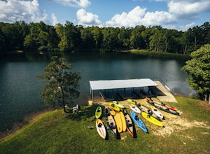
4.3If you love everything outdoors, the Hydaway Outdoor Recreation Center is the place for you! You can do almost any activity you can think of here. If you aren't affiliated with Liberty University, you can't rent their equipment, but you can bring you own to use. The main attraction is the lake wh...Read more -
Tyro, Virginia
Crabtree Falls
4.53.05 mi / 1161 ft gainThis is an approximately 3 mile roundtrip hike. It will usually take anywhere from 1-2 hours to get up, depending on your experience and who you have with you, and about an hour down. As you come off of route 56, you will come up to the trailhead where there is a large parking area with restroom...Read more -
Big Island, Virginia
Hike to Little and Big Rocky Row
5.010.8 mi / 2700 ft gainStarting at the James River Footbridge, which is the longest foot traffic only bridge on the entire Appalachian Trail. Head north on the Appalachian Trail. You will quickly cross over Rt. 501. After a mile of hiking through the woods skirting the Rocky Row Run stream, you will cross over Forest ...Read more -
37.8962002590409,-79.0456008911133, Virginia
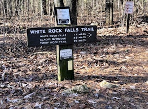
White Rock Falls Trail
4.02.82 mi / 558 ft gainWhite Rock Falls Trail is an out-and-back trail that takes you by a waterfall located near Montebello, Virginia.Read more -
Roseland, Virginia
Backpack Reeds Gap to Rockfish Gap
5.020 miNote: We usually get a chance to take this trip in the summer, so please pay attention to the weather and pack accordingly. This description is for a July/August hike and the temperatures were in the 80s during the day and 60s at night. During this time of year rain showers are always a possibili...Read more -
Lyndhurst, Virginia
Backpack Three Ridges Loop
4.614.2 mi / 3960 ft gainFrom the parking area at Reids Gap, start off on the white-blazed A.T heading south as the trail begins on the left side of a clearing. You will begin climbing Meadow Mountain shortly and in .8 miles arrive at the top of the ridge, where you will continue on downhill for another .8 miles until y...Read more -
Vesuvius, Virginia
Hike to White Rock Falls
3.52.4 miPark in The Slacks Overlook parking lot on the Blue Ridge Parkway, around milepost 20. From there exit the parking lot back onto the road and head left. About 300 feet from the parking lot there is the trail entrance. It isn't too hard to find if you are looking for it, but there aren't any marki...Read more -
Lyndhurst, Virginia
Camp at Sherando Lake
4.0Sherando Lake is a beautifully maintained dog/family friendly campground situated between two lakes. Upper Sherando Lake is available for fishing only but the larger, 25 acre, Lower Sherando Lake offers swimming, fishing, kayaking, and relaxing on the beach. The campground is divided into three ...Read more

