Skykomish, Washington
Top Spots in and near Skykomish
-
King County, Washington
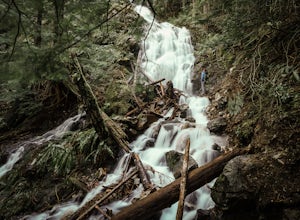
Teneriffe Falls (Kamikaze Falls)
4.55.64 mi / 1732 ft gainThe lesser known Mt Si Rd trail starts off as a relatively flat road. This continues for two miles until you reach the Teneriffe Falls sign. Upon turning right at this junction, the terrain takes a shift and the incline steepens. This is where most of the elevation is gained. The rest of the way...Read more -
Granite Falls, Washington
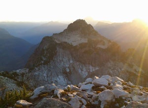
Vesper Peak Trail
4.06.59 mi / 3927 ft gainThis hike is very strenuous, but nothing unconquerable! The views at sunset were once in a lifetime and something I will remember for the rest of my life. The first half mile or so of the trail begins in a wooded area then opens up to views of the lower valley. After hiking for about another ½ t...Read more -
North Bend, Washington
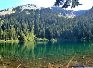
Annette Lake
4.57.2 mi / 1923 ft gainFrom Seattle drive east on I-90 to exit 47 (Asahel Curtis/Denny Creek). Turn right from the off-ramp and continue 0.25 mile, then turn left on Forest Road 5590. You'll find the parking area in 0.3 mile. Between the thick second-growth forest stands and the high alpine lake, the trail rolls along...Read more -
North Bend, Washington
Talapus Lake Trail
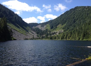
3.43 mi / 781 ft gainThe trail up to Talapus Lake is well graded and relatively short, at only about 2.5 miles in length RT. The trail starts off on a wide old road cut and then veers off into the old growth woods in a slowly winding uphill tack. A few mellow switch backs deliver you to the top, where a short stretch...Read more -
North Bend, Washington
Talapus & Olallie Lakes
5.71 mi / 1266 ft gainWith a moderate grade on a wide trail, the hike to Talapus Lake is the perfect introduction to the outdoors for hikers and beginning backpackers. Upon arrival at Talapus, break out lunch or pitch camp. Either way, you can cool off in the large lake. If you feel like pressing on, Ollalie Lake is j...Read more -
North Bend, Washington
Mt. Si
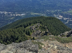
4.67.91 mi / 3241 ft gainMount Si is probably one of the most well trekked hikes around the Seattle area, but one that any hiker-new to the game or an old pro-should experience as least once. I usually use it as a starter hike to kick start the season and highly recommend you get an early start on this one as the further...Read more -
North Bend, Washington
Swim in the South Fork of the Snoqualmie River
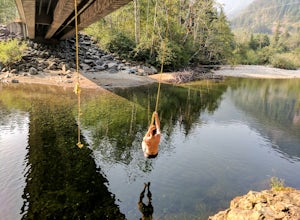
5.0You can reach this area off I-90. Take exit 38. If you are coming from the west (Seattle) take a right after exiting the highway and continue for about 2 miles. You will drive under I-90 and then come to a parking area. This is it! If you are coming from the east it's even easier, turn right...Read more -
North Bend, Washington
McClellan Butte
5.010.61 mi / 3629 ft gainStarting at the McClellan's Butte Trailhead, right off of I-90 exit 47, head out on the main (only) trail at the trailhad. The first half mile of the trail is quite easy as it meanders through the forest, but don't be fooled or worried, it will get harder. This first half mile has a crossing of a...Read more -
North Bend, Washington
Drive Along the Middle Fork Snoqualmie River
5.0Some days you don't need to tackle a grueling summit or long mileage loop, just getting outside the city is enough. Driving forest roads is always an adventure and pays its dividend in seclusion, viewpoints, and peacefulness. The Middle Fork Snoqualmie (FR56) offers a photo enthusiast numerous pi...Read more -
North Bend, Washington
Sport Climbing at Exit 38, Deception Crags Area
4.0Sport Climbing at Exit 38, the Deception Crags Area, is an amazing area to climb within 1/2 hour drive of downtown Seattle. It is an amazing resource for climbers living in Seattle, as during the spring, summer, and fall, it can be reached quickly afterwork, with minimal traffic.There are 5 disti...Read more -
North Bend, Washington
Hike Mount Washington
4.32.89 mi / 3058 ft gainYou start out at an elevation of about 1200 feet and you gradually make your way up to the top at 4450 feet. You are hiking through forest land the whole time with peaks of a beautiful view to the north every so often. Along the way there are many rock walls which you can climb at, however on our...Read more -
Snoqualmie Pass, Washington
Hike Mount Catherine
5.03 mi / 1300 ft gainStart off on the extremely rough Forest Service 9070 road. Follow this for just over 4 miles until you see a sign for trail #1348 on the right. There is only enough room for a couple cars at the trailhead.You start off climbing right away, covering 800 feet of elevation in the first 0.80 miles of...Read more -
Snoqualmie Pass, Washington
Hike to Margaret Lake
6 mi / 1800 ft gainStarting at an elevation of 3,300 feet, begin the hike on a steep gravel road for 1/4 of a mile. Take a left onto a dirt road that will lead to an area of clear cuts and windy switchbacks.As daunting as this may seem, don't be discouraged. On a clear day, the surrounding peaks of Snoqualmie Pass ...Read more -
Ronald, Washington
Spade and Venus Lakes
5.026.47 mi / 2300 ft gainNestled in a high rocky cirque near the upper reaches of Mt Daniel, Spade and Venus Lakes are two of the most remote lakes in the Alpine Lake Wilderness. But to experience this level of pure isolation, you'll need to earn it; the shortest hike in to the lakes is 14 miles, the majority of which i...Read more -
Snoqualmie Pass, Washington
Lillian Lake
5.08.36 mi / 2969 ft gainWe backpacked our way to Lillian Lake and set up camp. There is a trail that lead around the lake and a trail that leads up to Rampart Lakes and Rachael Lake as well. We found a few more camps spots on Lillian Lake, then we noticed that only ONE other camp spot was being used. If you want peace ...Read more -
North Bend, Washington
Twin Falls
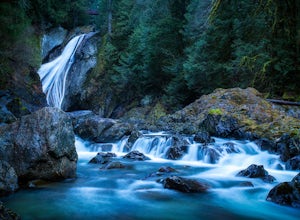
3.32.51 mi / 778 ft gainFor a portion of this 3-mile hike, you'll trek next to the South Fork Snoqualmie River, so take in the peaceful sound of the river running. Along the trail runs a river, where massive boulders create wading pools of icy water for warm summer days. At 1.5 miles, you'll reach a viewpoint bridge, wh...Read more

