West Virginia
Looking for the best photography in West Virginia? We've got you covered with the top trails, trips, hiking, backpacking, camping and more around West Virginia. The detailed guides, photos, and reviews are all submitted by the Outbound community.
Top Photography Spots in and near West Virginia
-
Davis, West Virginia
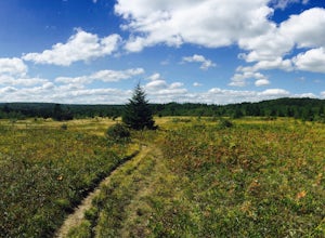
Bear Rocks Loop
4.710.54 mi / 1293 ft gainThis particular hike is great as there are multiple camping sites, both established and backcountry, and views for miles around almost every bend. Still not convinced? This high-altitude plateau has characteristics typically found in Canadian landscapes. so you can travel north without leaving y...Read more -
Seneca Rocks, West Virginia
Seneca Rocks Trail
4.73.12 mi / 784 ft gainSeneca Rocks is probably one of the best known landmarks in West Virginia. This iconic formation sits 900 feet above the North Fork River. I highly recommend anyone interested in taking a trip to West Virginia take some time to visit Seneca Rocks. These rock formations are really an amazing site....Read more -
Wardensville, West Virginia
White Rocks Loop, George Washington NF
4.59.26 mi / 1690 ft gainThe trail begins near the upper parking area next to a closed gate. If you park in the lower parking area, you'll have to walk about .3 miles up the road to get to this gate. Start out on the forest service (FS) orange-blazed trail, following it for about a quarter mile. From there head onto Old...Read more -
Danese, West Virginia
Photograph the Glade Creek Grist Mill
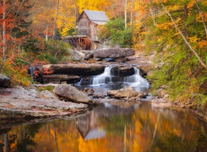
5.0Hidden deep in the Appalachian Mountains near the New River Gorge sits an extremely photogenic grist mill. A recreation of the original mills that dotted West Virginia, Glade Creek Grist Mill was completed in 1976 at Babcock SP. Built fully operational from the parts of 3 other WV mills, it was p...Read more -
Princeton, West Virginia
Brush Creek Falls
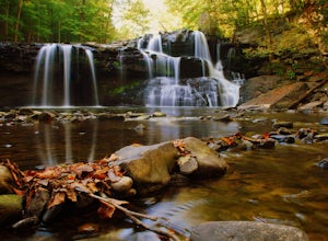
4.50.5 mi / 75 ft gainBrush Creek Falls is a beautiful 25' waterfall that spans across Brush Creek. It is accessed via a short 0.5 mile hike with minimal elevation gain. From the parking area on Brush Creek Falls Road, take the trail to the right of the picnic shelter. This easy and relatively-flat trail through rhod...Read more -
Davis, West Virginia
Camp at Blackwater Falls State Park
5.0Blackwater Falls State Park is one of 36 state parks in West Virginia and is located just north of the Canaan Valley less than two miles from Davis, WV. Blackwater Falls State Park has over 2,000 acres, making it a great place to camp while you explore the beautiful area. The campground has 65 ...Read more -
Shady Spring, West Virginia
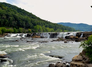
Sandstone Falls
5.00.52 mi / 46 ft gainStarting at the trailhead, follow signs for the falls. After a short walk, hikers will reach the walkway bridge where they can snap a couple shots of the minor Sandstone Falls to the right. Many hikers stop here, thinking these falls are the final destination. Do not make this mistake—the best is...Read more -
Wardensville, West Virginia
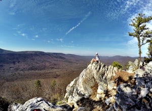
Tibbet Knob via Wolf Gap
5.03.17 mi / 702 ft gainPark for free at Wolf Gap Campground and cross the road where you will pass some picnic tables and campsites. Follow the signs to the yellow-blazed Tibbet Knob trail. In half a mile, there is a little path to a summit on your left where you can catch a glimpse of Mill Mountain and Big Schloss. ...Read more -
Thomas, West Virginia
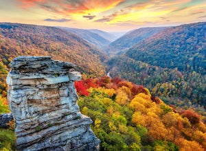
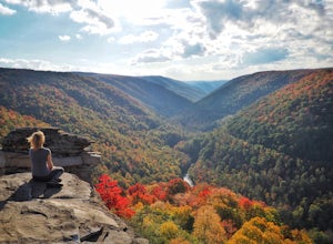
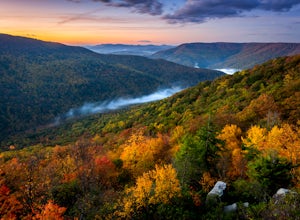
Hike to Lindy Point in Blackwater Falls State Park
4.80.83 mi / 59 ft gainIf you go to Blackwater Falls State Park for the falls, stay for the overlooks. This one, the most popular in the park, overlooks Blackwater Canyon from 3,000 feet above. Although the parking area at the trailhead is small with room for only 4-5 cars, you can also park along the road or at the ...Read more -
Maysville, West Virginia
Lions Head Loop
5.020.35 mi / 2195 ft gainWhat used to be an artillery testing site during WWII, Dolly Sods is a great place for backpackers of almost any expertise. Water is easily found throughout the wilderness area and while 21 miles might feel like a lot, it is very manageable over the course of 3 days. Attached (at the bottom) is...Read more -
Davis, West Virginia
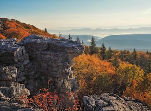
Photograph Bear Rocks Preserve
5.0The Bear Rocks Preserve is a 477 acre land tract maintained and supported by The Nature Conservancy. Offering a diverse range of plant species more commonly seen in the Northeast, visitors will find blueberries, huckleberries, mountain laurel, azalea, and rhododendron among the sandstone outcrop...Read more -
Parsons, West Virginia
Hike Table Rock
4.71.2 mi / 200 ft gainThis hidden gem is located near Lindy Point and Blackwater Falls State Park. Unlike Lindy Point, which is very popular, hikers are usually able to enjoy the views from Table Rock all by themselves. The Table Rock trail head is located off of Canaan Loop Rd. I highly recommend driving to the tr...Read more -
Davis, West Virginia
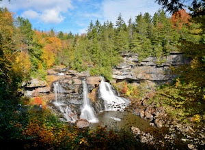
Photograph Blackwater Falls
4.7Blackwater Falls State Park is a lesser known state park in northern West Virginia. The waterfall is easily accessible. From the parking area go to the back of the horseshoe (the parking area is shaped like a horseshoe) and follow the path and steps down into the gorge. If you're planning on visi...Read more -
Edmond, West Virginia
Hike the Endless Wall Trail
4.72 mi / 260 ft gainFrom the Fern Creek Trailhead this is a 2.0 mile out and back hike to Diamond Point. The trail is relatively flat with minimal elevation gain and has a bridge stream crossing. When you arrive at the sign stating "Climber's Access", take a short side trip here to see the views of the gorge. Contin...Read more -
Edmond, West Virginia
Beauty Mountain Trail
5.01.1 mi / 279 ft gainThe Beauty Mountain Trail Head is located less than 10 miles form Fayetteville, WV. To reach the trail head, you will have to travel down some very narrow roads, and I recommend going old school and printing out the directions because cell service in the area is not the best. Once at the trail ...Read more -
Fayetteville, West Virginia
Hike the Long Point Trail
4.83.2 mi / 200 ft gainWith minimal elevation gain, this 3.2 mile hike can be done in a short amount of time. From the parking lot, take the trail to the right of the bathroom. There will be two trail intersections at 0.4 miles and 0.7 miles, both of which are well marked. Stay straight at both intersections to remain ...Read more

