White Rock, British Columbia
Looking for the best hiking in White Rock? We've got you covered with the top trails, trips, hiking, backpacking, camping and more around White Rock. The detailed guides, photos, and reviews are all submitted by the Outbound community.
Top Hiking Spots in and near White Rock
-
Olga, Washington
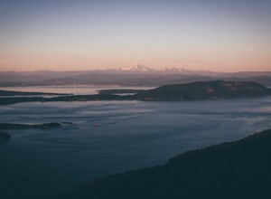
Hike to the Mount Constitution Summit
5.07 mi / 1500 ft gainThis 7 mile round-trip hike takes you to the mountain's summit. From here you'll be able to take in an amazing view. During the hike, you'll head around the left side of Mountain Lake, and then continue on to Twin Lakes, before starting your jaunt to the top of Mt. Constitution. The hike around ...Read more -
Pitt Meadows, British Columbia
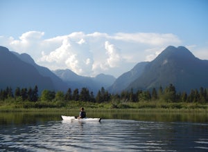
Paddle Pitt Lake to Widgeon Falls
5.03.7 miThe 12km (7.5 mi) drive on Neaves Road to Pitt Lake from Pitt Meadows is one of BC's most scenic routes. As soon as you start this section of the drive you already feel miles from the city, but this route is only 30-45 minutes from Vancouver, depending on city traffic.Once you reach the parking l...Read more -
Moran State Park, Washington
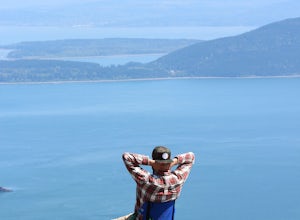
Camp at Moran State Park
Moran State Park is an true gem within the beautiful San Juan Islands. The park takes up a large portion of the East side of Orcas Island, the largest of all the San Juans. There are multiple campgrounds within the park along the shores of Cascade Lake and Mountain Lake. For the most relaxing exp...Read more -
North Vancouver, British Columbia
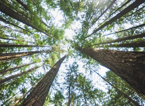
Hike the Lynn Canyon Loop
4.44 miThe Lynn Canyon Loop is a 5km trail that takes you up through the dense forest before looping back along the rushing water of the river.There are several trail systems throughout Lynn Headwaters Regional Park, that cater to every ability. Depending on what you're looking for, Lynn Canyon can prov...Read more -
North Vancouver, British Columbia
Hike Rice Lake
3.4Walk down Rice Lake Road, cross the bridge, and follow the pathway towards the park ranger buildings. Past the buildings you will find a gravel path going into the trees, which will take you towards a fence beside the trail. Continue on the path towards the lake, while the trees and moss along th...Read more -
North Vancouver, British Columbia
Hike Mount Seymour to First Peak
4.0The elevation gain to first peak is approximately 451m and is about 9km.There are several ways to get to the top, each trail is marked well. One way is to follow the ski run up to brockton point and then take the turn off to Mount Seymour. Do not follow the Elsay Lake trail as it's signifciantly ...Read more -
North Vancouver, British Columbia
Hike and Camp on Mt. Seymour
From the end of the parking lot next to the BC Parks sign board, walk towards the ski run and follow it uphill to a green sign on the left. The first trail goes to Dog Mountain, another scenic and shorter hike then Mount Seymour. Instead, follow the trail that heads uphill and parallel to the ski...Read more -
North Vancouver, British Columbia
Snowshoe Dog Mountain
2.7 mi / 328.1 ft gainA perfect way to get outside before or after work. Dog mountain is an easily accessible snowshoe trail that takes you up to the short peak from the Mt. Seymour parking lot. This is a perfect spot for sunrise or sunset photography, and you can catch great 360 views from the top. Start at the BC Pa...Read more -
North Vancouver, British Columbia
Hike Dog Mountain, BC
4.23.1 mi / 150 ft gainThe trail begins in the furthest northwest corner of the parking lot, by a big trail map. The start of the trail is gradual and meanders through the forest. The trail then begins to become more technical and requires scrambling over rocks and up areas with roots. Although this hike has minimal ga...Read more -
North Vancouver, British Columbia
Hike to Mystery Lake
4.03.1 mi / 492.1 ft gainFrom the Mt. Seymour ski area parking lot, head towards the Mystery Peak Express. Once you have passed the base of the Mystery Peak Express, you will continue up the trail to your left (right goes to dog mountain, straight to the 3 peaks of Seymour). Follow the trail all the way up to the lake. T...Read more -
North Vancouver, British Columbia
Hike to Norvan Falls
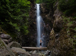
4.38.7 miThe trail starts in Lynn Headwaters Regional Park. This is a fantastic day hike that give you just enough of a challenge but isn't too long. It's about 14km to the norvan waterfalls and back ( 7km each way) and it totally work the walk. There is very minimal gain on this hike. The first bit of th...Read more -
Maple Ridge, British Columbia
Hiking Golden Ears Trail
14.9 mi / 4921.3 ft gainGolden Ears is well known to those in the Lower Mainland. After staring at the jagged 'ears' from all angle, I finally got to see them up close and in-person. The West Canyon Trail is a gentle 5.5 kilometers on a well groomed path, lined with deciduous trees making it a perfect place to watch the...Read more -
Maple Ridge, British Columbia
Camp in Golden Ears Provincial Park
11.2 mi / 3937 ft gainBackcountry permits are required to camp on Panorama Ridge ($5) and can be paid online.The trailhead is located at the West Canyon Parking lot. The trail starts out on a relatively flat old logging road. The trail slowly gains elevation over three kilometers taking you through thick green forest ...Read more -
Maple Ridge, British Columbia
Summit Golden Ears
4.514.9 mi / 5039.4 ft gainDay 1 Starting from the Golden Ears parking lot, your journey begins up a relatively small incline passing two bridges and entering the forest. Continue through the forest passing small cliffs and revealing some views of what you are going to climb the next day. Your estimated time it should take...Read more -
Maple Ridge, British Columbia
Hike to Alder Flats in Golden Ears Provincial Park
4.06.8 mi / 918.6 ft gainIf you're looking for a challenge and hope to get into the mountains this is a great adventure to set out on.Be prepared: Water, a lot of time, and with an understanding of the elevation gain will be important. This hike to the viewpoint of Alder Flats (overlooking the ears) takes around 2 hours ...Read more -
Maple Ridge, British Columbia
Hike the East-West Canyon Loop
8.1 mi / 1640.4 ft gainPark your car in the Gold Creek Parking lot ( at the end of the dirt road), and look for a yellow gate at the far end of the parking lot. This will be the East Canyon trail.The first part of the trail winds through the forest and you emerge on an old logging road. Follow this road along with the ...Read more

