
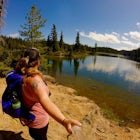
Kaila WaltonExplorer
I grew up on Denman Island BC, Canada and now I am currently based in Yellowknife. I love hiking, photography and road trips. I'm also a huge waterfall junkie.

Hellroaring Falls
Penny, British Columbia
5.0
0.84 mi
/ 66 ft gain
Once you are at the trailhead, the hike to the falls is relatively short. The first section of the trail is a bit overgrown with devils club. I would recommend wearing pants and not shorts. There is a steep hill at the beginning, with a rope for assistance and then the trail quickly levels out. The last bit of the walk is absolutely beautiful. The whole forest is covered with moss as if it were...

Hike the Shipyard/Titanic Trail
Tumbler Ridge, British Columbia
4.3
2.5 mi
/ 400 ft gain
This hike already starts in the alpine, but still gains a decent amount of elevation. While hiking on the trail you walk through alpine forests, big boulders, and a beautiful alpine meadow. There is a formation of gravity defying rocks called the Spanish Armada and with a little bit of an imagination it kind of looks like a shipwreck on a mountain. Hiking further, and up higher past the Shipwre...

Hike the New Hazelton Lookout and Waterfall Trail
South Hazelton, British Columbia
4.0
1.2 mi
/ 49.2 ft gain
This waterfall almost looks like it belongs in Oregon or Washington but instead its in Northern British Columbia in a cute little mountain town. The hike is an easy, gradual and well maintained trail.
To get to the trailhead drive to the end of Laurier Street in New Hazleton and you'll see the signs for waterfall and lookout trail. Stay to the left on the trail and you will end up at the water...

Hike to Cascade Falls, British Columbia
Fraser Valley F, British Columbia
4.8
0.5 mi
/ 131.2 ft gain
When you get to the parking lot go past the access gate and follow the very well maintained trail. The hike to the viewing platform is all uphill, but short. After a couple minutes you will reach wooden stairs that take you to a viewing platform as well as to the suspension bridge where you can cross it to a secondary viewing platform.There are some very steep cliffs around the falls so be very...

Hike through Boyle Point Provincial Park
Denman Island, British Columbia
5.0
2.2 mi
/ 115 ft gain
Boyle Point Provincial Park is located on Denman Island British Columbia Canada. To get there you take the Denman Island Ferry from Buckley Bay off Hwy #19A on central Vancouver Island. Take the Buckley Bay exit #101 from Hwy #19A. Once on the island, follow Denman Road to the Hornby Island Ferry terminal; turn right and follow East Road to the end and you will see the sign for the park.After y...

Photograph Whales out of Telegraph Cove
Telegraph Cove, British ColumbiaTo get to Telegraph Cove it is about 2 hours north of Campbell River. Head north as if you are driving to Port Hardy, the road is paved and in good condition. Just follow the highway signs to Telegraph Cove, they are hard to miss.
There is a great boat charter, Stubbs Island Whale Watching, that is very informative and takes people on a 3.5 hour tour around the waters near Telegraph Cove. This ...

Explore Hixon Falls
Hixon, British Columbia
4.3
1.23 mi
/ 197 ft gain
The 100 foot Hixon Falls cascades into a deep pool, and then flows down into two more deep pools. The walk to Hixon Falls is short and easy, but once you are at the big rock there is a not so sturdy 2x4 piece of wood used as a make shift bridge to get closer to the falls. Be very careful crossing it as it's ultra slippery. 100% worth the scary shuffle to the other side. Once across you can get...

Explore Fillongley Provincial Park
Denman Island, British Columbia
4.0
1.6 mi
/ 60 ft gain
Fillongley Park is located on Denman Island. To get there take the Denman Island Ferry from Buckley Bay, off Hwy #19A on central Vancouver Island. Take the Buckley Bay exit #101 from Hwy #19A. Once on the island, follow Denman Road to Swan Road. Turn left on Swan Road, then right on Beadnell Road all the way down to the parking lot and camping area.There is a loop trail that takes you to a beau...

Explore Lupin Falls
Comox-Strathcona D, British Columbia
5.0
The drive to Lupin Falls from Courtenay BC is approximately 1.5 hours. Along the way you will drive past beautiful lakes, forests and mountains. Once at the parking/day use area the trailhead for Lupin Falls is on the opposite side of the road. Everything is very well marked and signed. The walk to the falls is a short one and it is in the middle of a 1km loop. There is a nice viewing area and ...

Hike to Nesbitts Knee Falls
Tumbler Ridge, British Columbia
1.2 mi
/ 131.2 ft gain
Nesbitts Knee Falls is a beautiful and large plunge waterfall. It is an easy trek to get to with 40 metres of elevation gain at the beginning of the trail and then it levels out for the rest of the walk while it follows Waterfall Creek upstream to the waterfall. There is a wooden bench near the end of the trail that has a great view of the waterfall, and its a perfect spot to relax and take som...

Photograph the Cleveland Dam
North Vancouver, British Columbia
4.0
Once you park in the parking lot near the dam, its fairly easy to tell where it is, and how to get there.
The awesome spillway looks like one of the worlds most dangerous slides, (don't slide down it), and Capilano Lake and the peaks of the Lions make for a great backdrop in North Vancouver.
Photograph the dam, and the cute little green building floating in the lake, and if you are up for it ...

Fort George Canyon Trail
Fraser-Fort George C, British Columbia
4.0
6.25 mi
/ 1050 ft gain
The hike to Fort George Canyon is relatively flat for the first half of the hike and then gradually starts to descend into the canyon with the final stretch a switchback trek right to the water.
It starts out walking through a cut block for around 2km and then you head into a lush green forest full of wild roses, bunchberry, ferns, alder, fireweed and many other plants. There are a few boardwa...

Hike to War Falls
Fraser-Fort George G, British Columbia
4.8
0.51 mi
/ 233 ft gain
The hike down to the main waterfall (War Falls) is a short one, and it's downhill most of the way. War Falls trail skirts along the McLeod River, which flows from War Lake. There are a couple of viewpoints along the trail to take in the smaller waterfalls along the river. The end of the trail gets you to a platform viewpoint of War Falls.
During the summer months (July, August and September) ...

Photograph Kittil Falls
Fraser-Fort George F, British Columbia
5.0
Kittil Falls is nestled near the edge of the Canadian Rockies. It is a peaceful site with only the sound of the waterfall to break the silence of the remote wilderness. The recreation site has about 2 campsites, one down stream of the waterfall and one right beside it. To get to the falls once at the Kittil Falls Recreation Site, you'll see a two-track path heading upstream of the creek. Follow...

Photograph Kinuseo Falls
Upper Fraser, British Columbia
4.0
1.2 mi
Kinuseo Falls is located in Monkman Provincial Park just south of Tumbler Ridge in Northern British Columbia. This waterfall is the largest one in the park. Believe it or not, Kinuseo Falls is also taller than Niagara falls in Ontario by about 9 metres.
Kinuseo Falls, on the Murray River, is situated 65 kilometres by road
south of Tumbler Ridge. To reach the falls follow the Heritage
Highway (B...

Beaver Falls
Fraser-Fort George H, British Columbia
4.0
1.2 mi
/ 25 ft gain
The hike is relatively flat, short, and goes along the Holmes River to Beaver Falls. What the waterfall lacks in height it makes up for in sheer volume and sound.
Along the way to the waterfall you walk through a lush green forest with lots of bunchberry bushes and other assorted wild flowers. Everywhere you turn during late spring you can see butterflies in the forest.
It's hard to tell how...

Hike to Twin Falls in Smithers BC
Smithers, British Columbia
4.0
0.9 mi
/ 164 ft gain
The short trek to the viewing platform is well maintained and all uphill. Once at the platform you can view both of the waterfalls cascading down into the valley. The best wait to get a photo of them both is with a wide angle lens. There are no trails directly to the bases of the waterfalls but if you use a telephoto lens you can get some nice close up photographs of them.
To get to Twin Falls ...

Centennial Loop Trail in Strathcona Provincial Park
Comox-Strathcona C, British Columbia
5.0
1.54 mi
/ 131 ft gain
Strathcona is the oldest provincial park in British Columbia and on their centennial year to celebrate, they built a 2km "every-body" accessible loop trail. It is wheelchair and stroller friendly, with boardwalks and large gravelled trails.
If you are looking for a quick hike with a taste of the alpine or a family that wants to get outside then this little hike is a perfect place to start. Pl...
Community
Mobile Apps

© 2024 The Outbound Collective - Terms of Use - Privacy Policy