Camptonville, California
The best trails and outdoor activities in Camptonville, California offer a unique combination of scenic beauty and challenge. The top choice among hikers is the Bullards Bar Trail, a must-visit that winds along the Yuba River, offering spectacular views of the surrounding forest and water. This trail is moderately difficult, making it suitable for those seeking a bit of a challenge. For a more relaxed outdoor adventure, the Oregon Creek Day Use Area is perfect for picnicking and swimming. If you're in for a bit of history, the nearby Malakoff Diggins State Historic Park offers trails that pass old mining sites. Whether you prefer hiking, swimming, or exploring history, Camptonville has something to offer.
Top Spots in and near Camptonville
-
Sierra City, California
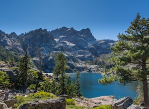
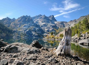
Sierra Buttes and Sardine Lakes
4.86.19 mi / 3333 ft gainThe Sierra Buttes are one of the most scenic mountain features in all of the Sierra Nevadas. Nestled below the buttes are Upper and Lower Sardine lakes which both offer amazing fishing. Sardine Lake Resort lies at the base of the mountains and offers boat rentals, dining and cabin rentals. Just m...Read more -
Calpine, California
Camp at Salmon Creek Campground
Salmon Creek Campground is a quiet campground in the Northern Sierra Buttes. Since it is right up the road from Sardine Lakes it seems to get overlooked a bit. We were able to reserve three campsites the same week of our trip. There were 11 to choose from! The campground is just passed the turn f...Read more -
Placer County, California
Paddle Lake Valley Reservoir
A perfect adventure spot off Highway 80, Lake Valley Reservoir offers paddlers prime parking and a paved boat launch to push off on a mountain lake with an island for picnicking. Lake speed is 10 mph so fishing boats with outboards are allowed but they have to take it slow. Post launch, head le...Read more -
Foresthill, California
Explore Sugar Pine Reservoir
4.3Just a few miles north of Foresthill, Sugar Pine is a lesser known reservoir found in Placer County that is surprisingly unpopulated for how much the park provides. A swim suit, some friends, and some good music can be all it takes to have a good time.There is a boat-launching station that is eas...Read more -
Penn Valley, California
Fairy Falls Trail to Shingle/Beale Falls
4.14.87 mi / 535 ft gainStart at the Fairy Falls trailhead in Spenceville Wildlife Area Field Trial Grounds in Penn Valley (careful on the bumpy roads in). From the parking lot, cross a small bridge and make a right onto a dirt road. After about a mile you will follow the road to the right and continue through the gate....Read more -
Calpine, California
Gold Lakes, Sierra Buttes, 45mi
If you never travel north of the Tahoe Basin into the Sierra Valley and beyond, you should. It is gorgeous, peaceful country, with wide open spaces and, compared to Tahoe, relatively uncrowded roads. This loops takes us from Bassett’s Station toward Sattley, north on 89, a brief stop to regroup i...Read more -
Colfax, California
Hike to the Jumping Rock on the Bear River
2 mi / 150 ft gainThough lesser known than its neighbors the Yuba and the American, the Bear River still features fantastic hiking, swimming, river-raft, tubing, and rock-jumping but without the crowds.A local favorite spot, the "Jumping Rock" near the Dog Bar Crossing, provides an excellent hike with several swim...Read more -
Plumas County, California
Hike to Little Jamison Falls
3.02 mi / 500 ft gainTo get to the falls from the town of Graeagle, CA take Graeagle-Johnsville off Highway 89 towards the town of Johnsville. After 4.5 miles take a left on a dirt road to Jamison Mine Day Use Parking. If you go over the bridge and into the town of Johnsville, you have gone too far. Continue down th...Read more -
Frazier Creek Road, California
Hike to Frazier Falls
4.01 mi / 1 ft gainFrazier Falls is the ultimate family hike. Because the paved trail is only a mile long round trip, this trail is open to nearly anyone. Because of its relativly easy access and family friendly nature, this trail can get busy during the summer months.To reach Frazier Falls from the town of Graea...Read more -
Oroville, California
Hike to Hollow Falls
5.01 miThe first step of this fun little hike is to park at the handy parking lot located at 2488 Cherokee Rd., Oroville, CA up on Table Mountain. Many people park here for the hike to the more well-known Phantom Falls, which is a much longer hike than the one to Hollow Falls. From the lot, look for an ...Read more -
Oroville, California
Hike to Phantom Falls
4.64.2 mi / 850 ft gainDropping off a 135 ft cliff is a very well hidden waterfall with no trails leading to it. But if you do find it, it is an epic natural wonder.It is best to come here in the winter months, after a lot of rain. But it is also well worth coming in the spring when the wildflowers on Table Mountain ar...Read more -
Oroville, California
Feather River Trail Upper Section
3.23 mi / 89 ft gainFeather River Trail Upper Section is an out-and-back trail that takes you by a river located near Oroville, California.Read more -
Emigrant Gap, California
33mi Loop to Donner Lake
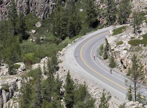
33 miWe love this 33-mile loop on old Highway 40 from Cisco Grove to Donner Lake and back. It has just about everything: a few flats, a long slow pull, rollers, a screaming downhill, a tough Alpine climb and a long, cruising downhill. Not to mention altitude. The ride starts at a little above 6,000 fe...Read more -
Emigrant Gap, California
Loch Leven Viewpoint Trail
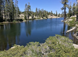
5.06.41 mi / 1522 ft gainLoch Leven Viewpoint Trail is an out-and-back trail to a viewpoint of the Loch Leven Lakes that is moderately difficult located near Truckee, California. This trail is just under 6.5 miles. If you're willing to add a little more than a mile to your adventure, you can head all the way to Upper Loc...Read more -
Loch Leven Lakes Trailhead, California
Loch Leven Lakes Trail
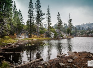
4.47.6 mi / 1480 ft gainThe trail is easy to follow for the first half mile until you get to some large slabs of granite. As you continue up the trail look for stacked rocks, these will give you a an easy route as you continue up the mountain. The trail then starts to switch back eventually leading to a small bridge. Af...Read more -
Truckee, California
Swim at Long Lake near Truckee
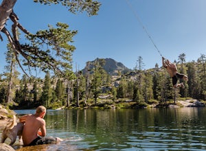
3.71.5 mi / 100 ft gainThe story goes that twenty or so years ago, long before the advent of the Royal Gorge Cross-Country Ski Area, some local Truckee boys decided to put a couple rope swings up on Long Lake near Soda Springs, CA, and they remain there to this day.Long Lake sits amongst a cluster of both man-made and ...Read more

