Camptonville, California
The best trails and outdoor activities in Camptonville, California offer a unique combination of scenic beauty and challenge. The top choice among hikers is the Bullards Bar Trail, a must-visit that winds along the Yuba River, offering spectacular views of the surrounding forest and water. This trail is moderately difficult, making it suitable for those seeking a bit of a challenge. For a more relaxed outdoor adventure, the Oregon Creek Day Use Area is perfect for picnicking and swimming. If you're in for a bit of history, the nearby Malakoff Diggins State Historic Park offers trails that pass old mining sites. Whether you prefer hiking, swimming, or exploring history, Camptonville has something to offer.
Top Spots in and near Camptonville
-
Truckee, California
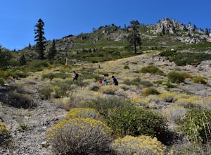
Mt. Judah Loop Trail
5.05.5 mi / 1700 ft gainA wonderful hike in Lake Tahoe is the Mt. Judah Loop Trail that offers sweeping views of Donner Lake and the surrounding Sierra Nevada mountains on the North Shore. As a resident on the North Shore, many of my recreational activities favor this side of the Lake but there are marvelous hikes in ...Read more -
Truckee, California
Cross-Country Ski to Drifter Hut
3.09.6 mi / 980 ft gainSet out from the Tahoe Donner Cross Country center in Truckee at 6,650 feet elevation. Day passes range from $12 to $34, depending on time of day and skier age, and provide access to over 100 kilometers of groomed trails. Leaving the day lodge, there are multiple options for skiing up to Drifter ...Read more -
Truckee, California
China Cove Loop at Donner Lake
4.63.11 miThis is a casual hike in an area with a ton of history. Stop by the museum before or after your hike to learn about the Donner Party, the Transcontinental Railroad, and local Native Americans Park at the Donner Lake and Memorial State Park Visitor Center and walk west towards the lake. Cross the...Read more -
Chico, California
Yahi Trail
8.88 mi / 541 ft gainYahi Trail is an out-and-back trail where you may see wildflowers located near Chico, California.Read more -
Chico, California
Hike the Yahi Trail in Upper Bidwell Park
7.9 mi / 836 ft gainTo start this hike, find parking at Bidwell Park Parking Area E, near the Chico Rod and Gun Club. From there walk a short ways down Upper Park Road. You will see the sign for the Yahi Trail trailhead on the right. From here, simply follow the trail along the river. A reminder to those with dogs, ...Read more -
Chico, California
Monkey Face Loop
1.27 mi / 279 ft gainMonkey Face Loop is a loop trail that takes you by a lake located near Chico, California.Read more -
Truckee, California
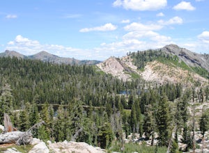
The Five Lakes Hike
4.0The Five Lakes Trail is located in the Granite Chief Wilderness in between Alpine Meadows and Squaw Valley ski resorts and is easily accessible at the intersection of Alpine Meadows and Deer Park roads. The 5-mile moderate trail ascends approximately 900-1000 ft. along granite canyons and pine f...Read more -
Truckee, California
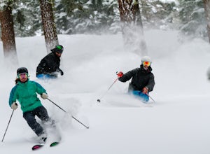
Ski Outer Outer Limits at Alpine Meadows
Starting off of Lakeview chair at Alpine Meadows, head to the far right towards the sign for Outer Limits run. Traverse across the run and past the Ski Area Boundary signs on the far side. Continue through the trees where you will find a series of clearings generally full of untracked powder. The...Read more -
Olympic Valley, California
Hike the Shirley Canyon Cascades Trail
3.6 mi / 2109 ft gainThis trail has lots of elevation over a short distance, be warned! The Shirley Canyon Cascades Trail is close to Olympic Valley in the North Lake Tahoe region. Dogs are allowed on this trail if kept on leash.Read more -
Truckee, California
Ski and Snowboard Northstar
3.5Northstar California, previously known as Northstar-at-Tahoe, is located near the north shore of Lake Tahoe and is home to over 3,000 acres of skiable terrain. The resort is known for its laid back atmosphere coupled with high-end luxury accommodations, shopping and dining.The resort is home to i...Read more -
Olympic Valley, California
Hike the Thunder Mountain Trail
5.03.2 mi / 2000 ft gainThe Thunder Mountain Trail is the perfect hike to explore the Squaw Valley Alpine Meadows. Squaw may be famed for its mountain ski runs in the winter, but when the snow melts in the summer, beautiful alpine meadows line the mountain and the ski runs turn into hiking trails! The Thunder Mountain T...Read more -
Olympic Valley, California
Hike to Lake Estelle and Five Lakes
6 mi / 1000 ft gainThis hike starts at Alpine Meadows Base Camp and finishes on Alpine Meadows Road. The end point is less than a half mile from the base, and an easy walk up a slight hill. Park at base camp and head on the trail to the far right of all of the lifts. Proceed up the trail for half a mile (this is th...Read more -
Truckee, California
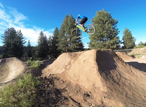
Ride the Truckee Bike Park
5.01 mi / 50 ft gainTruckee bike park is a great destination for all ages of bike riders. There are several different features including a pump track, dual slalom course, dirt jumps, strider track and more! This park is kid friendly but be sure to pack a helmet and pads especially for first-timers. More experienced ...Read more -
Roseville, California
Explore The Solo Tree
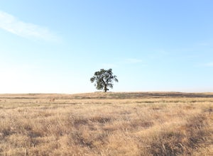
3.0Disclaimer: This tree is on private property. If you choose to proceed, please check in with the property owner and proceed respectfully.The Solo Tree (often referred to as #thatrosevillesolotree on Instagram) has become a very popular photography spot in the Roseville area.Drive as far west as y...Read more -
Tahoe City, California
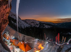
Ride Twin Peaks in Lake Tahoe's Backcountry
This trip is best done in two days with an approach day and then a descent day. Get started at the base of the Sherwood Chair on the backside of the Alpine ski area. Head up, outside of the ski area boundary toward the high ridge.Once on the ridge, you follow it south for a few miles until reachi...Read more

